Upington Airport
“
— ”
Upington Airport is an airport located in Upington, Northern Cape, South Africa. Between 1976 to 1996, South African Airways, the national carrier of South Africa, used the airport as a refueling stop for its Boeing 747 flights to Europe. South Africa had been stripped of airspace and landing rights for South African carriers in most other African nations because of the state policy of apartheid. As a result, the number of airports which could serve as refueling stops for certain long-haul flights, was drastically reduced, and an entire area of airspace was denied for South African carriers. As a stop-gap solution to the increased flight time as a result of having to fly around the majority of the African continent in order to reach Europe, South African Airways long-haul flights between South Africa and Europe flew from Johannesburg to Upington, refueled, and then resumed their journey over the Atlantic, and finally on to Europe, in order to avoid unfriendly airspace.
As a response to the implementation of apartheid in South Africa, various attempts have been made by anti-apartheid nations to isolate the country. Aside from political and economic pressure on South African trade, such as by freezing the assets of South African business travelers, tourists, sportsmen and state officials, most of them White, the spotlight fell on air travel. In an age when sea journeys were increasingly being curtailed, air traffic was becoming increasingly vital to link nations together. An envisioned air blockade of South Africa involved the severance of air links between South Africa and hostile nations, the disruption of international services operated by South Africa’s state-owned airline, and threats to curtail the rights of other carriers flying between the Republic and states uncommitted to sanctions. The geography, timing, mechanics and impact of these measures might be viewed best against the backdrop of the initial expansion of air transport to and from South Africa.
The runway of Upington Airport is forty-nine-hundred meters long, one of the longest runways in the world. The land around Upington Airport is flat. The high elevation of the airport, coupled with extremely high summer temperatures, made for difficult take-off conditions for large planes, thus necessitating the extreme length of the main runway. Specifically, the runway was designed for the Boeing 747 with a full load of passengers, cargo, and fuel, so that it could take off for Europe without having to stop along the way. Upington was chosen because of its strategic position, availability of land and comparatively lower height above sea level than Johannesburg.
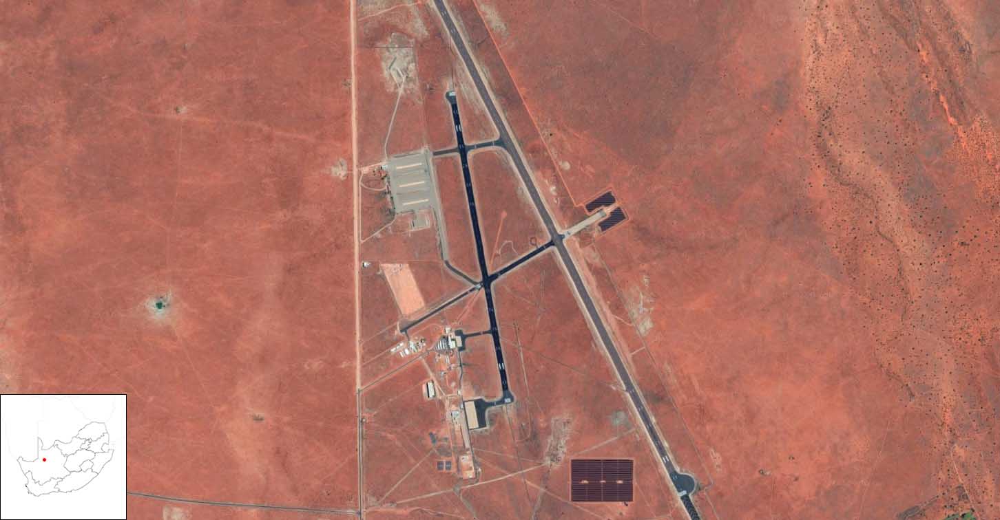
Image source:
Google, n.d., “Upington Airport.” Accessed March 6, 2022.
References
1. “Upington Airport.” In Wikipedia, September 27, 2021. https://ceb.wikipedia.org/w/index.php?title=Upington_Airport&oldid=33120119.
2. X-Plane.Org Forum. “FAUP Upington Intl.” Accessed March 6, 2022. https://forums.x-plane.org/index.php?/files/file/25571-faup-upington-intl/.
3. Pirie, G. H. “Aviation, Apartheid and Sanctions: Air Transport to and from South Africa, 1945—1989.” GeoJournal 22, no. 3 (1990): 231–40.