Rainfall Line
“
— ”
South Africa is divided by the 500 mm rainfall line, which runs across the country from Port Elizabeth in the eastern Cape through the middle of the Free State into the western Transvaal. Northwest of this line, annual rainfall often remains below 200mm whereas to the East typically receives 500-900 mm of rainfall per year. A large area of the center of the country receives about 400mm of rain, on average, and there are wide variations closer to the coast. The 400mm "rainfall line" has been significant because land East of the rainfall line is generally suitable for growing crops and; and land West of the rainfall line suitable only for livestock grazing or irrigation-intensive crop cultivation.
The ability to effectively farm or raise livestock across the South African territories is evidenced in the geographic spread of pre-colonial populations. The dense settlements of iron-using, cultivating, Bantu-speaking African people, who had for centuries made up the bulk of the country's population, lived mostly in the regions east of the rainfall line, unable to penetrate into the more fertile pockets to the west around the Cape Peninsula. The Khoisan hunters, gatherers, and herders largely occupied the western Cape and the drier parts of the interior . Xhosa communities also penetrated into the dry northern Cape in the early nineteenth century. The major exception has been the Tswana chiefdoms whose territories straddied the semi-arid highveld plateau regions in the current Free State and Gauteng territories. These pre-colonial settlements reveal that more-densely occupied settlements within present-day South Africa before the twentieth century were largely restricted to areas with higher rainfall.
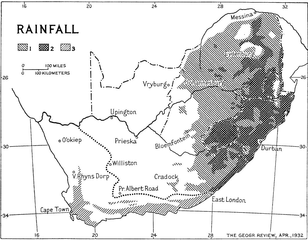
Image source: Wellington, John H. “Land Utilization in South Africa.” Geographical Review 22, no. 2 (1932): 206. https://doi.org/10.2307/209174.
References
1. Wellington, John H. “Land Utilization in South Africa.” Geographical Review 22, no. 2 (1932): 205–24. https://doi.org/10.2307/209174.
2. “South Africa Weather and Climate.” Accessed March 6, 2022. https://www.sa-venues.com/no/weather.htm
1. Wellington, John H. “Land Utilization in South Africa.” Geographical Review 22, no. 2 (1932): 205–24. https://doi.org/10.2307/209174.
2. “South Africa Weather and Climate.” Accessed March 6, 2022. https://www.sa-venues.com/no/weather.htm