Project Global: Ground


This exploration of our current day metropolitan condition as a system of systems deals with the crust of the Earth as a primary carrying capacitor of human activities, from the extraction of resources deep within the ground, to agricultural operations that barely scratch the surface.

Part 1: Lexicon

Part 2: Atlas

Part 3: Architectural Projects


Part 1: Lexicon index

︎ Formation

    ︎ Kaapvaal Craton
    ︎ Johannesburg Dome
    ︎ Vredefort Dome
    ︎ Topsoil
    ︎ Müggelsee


︎ Measurement    ︎ Schwerbelastungskörper
    ︎ Mining Earthquakes
    ︎ Low-tech Soil Testing
    ︎ Soil Texture Triangle
    ︎ Geologic Time Scale 
    ︎ Stratigraphic Colum
    ︎ Geographic Information System
    ︎ Ecotone
    ︎ Cultural Landscape

︎ Prototype
    ︎ Unter den Linden
    ︎ Zoological Landscape
    ︎ Counterculture
    ︎ Cultural Agency
    ︎ Mine-pit Lakes
    ︎ Parliament of Things

︎ Land distribution
    ︎ 1913 Natives Land Act
    ︎ District Six
    ︎ Eavesdropping
    ︎ Reconciliation Policy
    ︎ Land Grabbing
    ︎ Land Acting
    ︎ The Red Ants
    ︎ #PutSouthAfricansFirst
    ︎ Suburban Enclaves
    ︎ Parallel State

︎ Extraction
    ︎ Cullinan Diamond Mine
    ︎ Platinum Group Metals
    ︎ Zamazamas
    ︎ Gold Rush Inertia
    ︎ Sinkhole
    ︎ Maize Doctor
    ︎ Coal Hands

︎ Infrastructure
    ︎ Gautrain
    ︎ Le-guba
    ︎ Lesotho Water Project
    ︎ Deutscher Wald
    ︎ Arrival City

︎ Production
    ︎ Safari Economy
    ︎ Agritourism
    ︎ Rainfall Line
    ︎ Upington Airport
    ︎ Tiergarten Transformation
    ︎ Pivot Irrigation
    ︎ Allotment Garden
    ︎ Bokoni Terracing
    ︎ Johannesburg Forestation
    ︎ Game Farming Cycle

︎ Waste
    ︎ Trümmerberg
    ︎ Fab-Soil
    ︎ Mining Waste Belt
    ︎ Sanitary Landfilling
    ︎ Soil Structure
    ︎ Biogas Technology

︎ Pollution
    ︎ Dry Stacked Tailings
    ︎ Water Pollution
    ︎ Soil Pollution
    ︎ Uranium Sandstorms
    ︎ Poaching

︎ Remediation
    ︎ European Green Belt
    ︎ Conservation Agriculture
    ︎ Airfield Urbanism
    ︎ Solar Park
    ︎ Gold Reef City
    ︎ Mine Pit Lake
    ︎ Loess Plateau
    ︎ Erosion Control


Le-guba

“ ⁠— ”


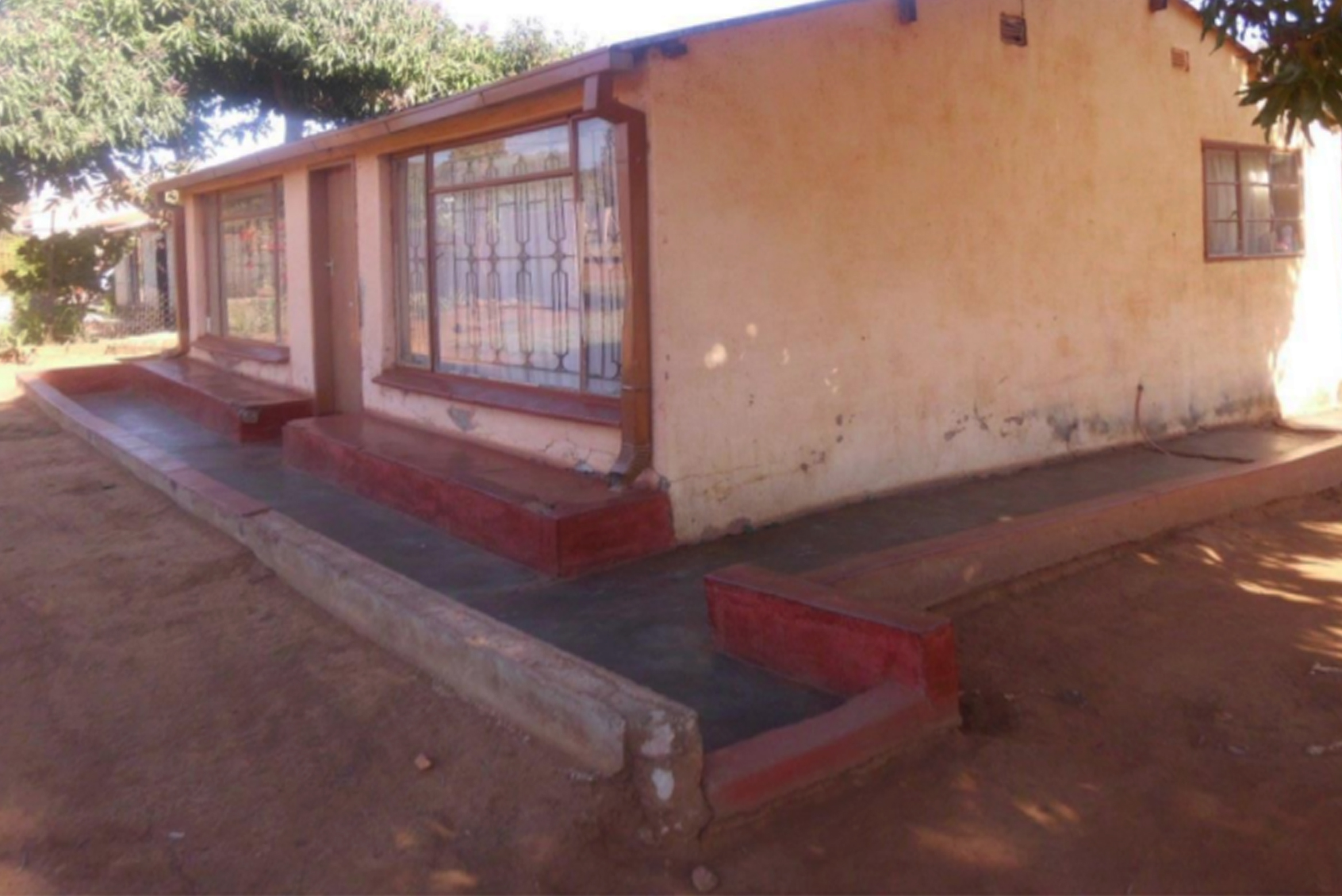
The community of Ga-kgapane Maskaneng is located on a former dumping site which became illegally occupied due to land availability shortages and increased population growth. This might be the primary reason why the local authorities did not construct a drainage system in these areas, making it vulnerable to floods. As a consequence of inadequate proper flow paths or channels, water accumulates in residential zones and agricultural land. Some houses were affected to such an extent that they collapsed.1
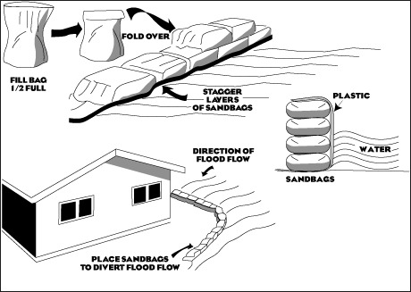
        The most prominent mitigation strategy that was developed in this area was to create 'Le-guba' around houses: stacked sand-bags around dug furrows around houses and on roads. In Ga-Kgapane, the 'Le-guba' was the most preferred coping strategy because they are easy to construct by hand and do not require many complicated materials to build. This coping strategy has been adopted in almost every household. This coping strategy generally proves that these areas experienced a serious problem of floods. A majority of houses without 'Le-guba' were cracked and some of them had collapsed due to the foundation of the house being completely exposed to flood.


Image source:  Munyai, Rendani Bigboy. “An Assessment of Community Flood Vulnerability and Adaptation: A Case Study of Greater Tzaneen Local Municipality, South Africa,” n.d., 60.


References
1.   Munyai, Rendani Bigboy. “An Assessment of Community Flood Vulnerability and Adaptation: A Case Study of Greater Tzaneen Local Municipality, South Africa,” n.d., 1-102.