Mine Pit Lake
“
— ”
A mine pit lake is the result of open-pit surface mining operations. Open-pit mining is used to extract a large ore body, creating large size gaps in the landscape. Flooding these mines represents a potential way to reclaim and sustainably use the degraded land. In many countries, the mine pit lake technique has been utilized to regenerate and introduce recreational areas where mines used to exist.1 The Lusatian lake district in-between the German states of Brandenburg and Saxony, and which contains several former gravel quarries, now sports several pit lakes as part of green belt projects. In South Africa, this technique has also been used to create tourist attractions in former mining cities.
The mine pit flooding process can be achieved through either passive or active flooding. Active flooding is the most common route, best suited for the rehabilitation of the water table of former open-pit mines. Here, water from rivers or other bodies of water is fed into the open-pit mine, accelerating the rise in the water level. However, only a relatively small number of open-pit mines are geographically located in such a way that they can be flooded by surface water through reasonable means. The water used for flooding often has to be pumped into the remaining open-pit mines over long distances, usually necessitating several pumping stations along the way.
The Big Hole, a four-hundred-and-three meter wide, two-hundred-and-forty-meter-deep mine pit lake located in Kimberley, the diamond mining center of South Africa, has become the main attraction of the city. In 1888, various mining operators in Kimberly decided to combine several disparate mines into one single mine, and all under De Beers Consolidated Mines Limited.2 Having extracted more than three-thousand kilograms of diamonds in a two-hundred-and-fifteen meter deep hole, this combined mine ceased operations in 1914, at the time the largest hand-dug excavation on Earth. The remaining open-pit mine was passively flooded over several decades, before forming the present day lake. Water continues to rise naturally from aquifers to fill the pit, at a water level about forty-meters deep at maximum.
Even though mine pit lakes could be considered a form of rehabilitation, the water quality of these lakes is often linked to contamination through residual mining waste, and can take some time to be suitable for recreational use. Thorough evaluations of the ecosystems in and around mine pit lakes need to be carried out, and comprehensive rehabilitation plans involving vegetation planting and water treatment drafted, before mine pit lakes meet popularly acceptable safety standards.
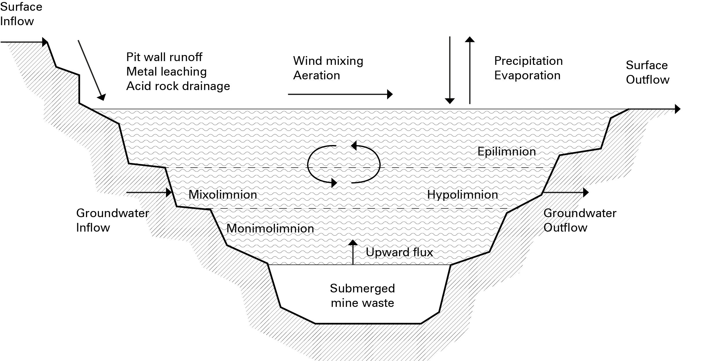
Image source: Fabiola Cruz
References
1. Apostu, Izabela-Maria, Maria Lazar, and Florin Faur. 2020. "A Model to Evaluate the Flooding Opportunity and Sustainable Use of Former Open-Pits" Sustainability 12, no. 21: 9275. https://doi.org/10.3390/su12219275
2. “Big Hole”, Wikipedia, accessed March 6, 2022, https://en.wikipedia.org/wiki/Big_Hole#cite_note-news24.com-2