Gold Rush Inertia
“
—
”
Ferreira's Camp was once one of three early camps where diggers and fortune seekers coming to Johannesburg settled - although meant only to be temporary, it soon became a formal settlement.
The Witwatersrand Basin holds the world's largest known gold reserves, and after gold was first discovered in the basin, the Gold Rush in 1886 became one of the biggest mineral revolutions in history, leading to the establishment of the city Johannesburg. Over 40,000 tonnes have been mined from these rocks since, accounting for approximately 22% of today’s current total of extracted gold.
One of the consequences of The Gold Rush was the establishment of the first working rail-lines: the Transvaal—Randtram line, built by NZASM from Johannesburg to Boksburg. Soon after, the news of the abundant gold in the Witwatersrand Basin spread around the world and prospectors from Australia to California arrived in masses. Johannesburg quickly grew to become the largest city in South Africa within 10years, outstripping the growth of Cape Town which was more than 200 years older.
![]() Image source:
“Jhb-City-Ferreiras-Camp-1886.Jpg (3895×1470).” Accessed March 6, 2022. https://johannesburg1912.files.wordpress.com/2011/02/jhb-city-ferreiras-camp-1886.jpg.
Image source:
“Jhb-City-Ferreiras-Camp-1886.Jpg (3895×1470).” Accessed March 6, 2022. https://johannesburg1912.files.wordpress.com/2011/02/jhb-city-ferreiras-camp-1886.jpg.
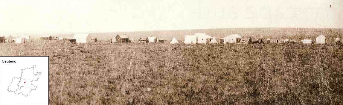 Image source:
“Jhb-City-Ferreiras-Camp-1886.Jpg (3895×1470).” Accessed March 6, 2022. https://johannesburg1912.files.wordpress.com/2011/02/jhb-city-ferreiras-camp-1886.jpg.
Image source:
“Jhb-City-Ferreiras-Camp-1886.Jpg (3895×1470).” Accessed March 6, 2022. https://johannesburg1912.files.wordpress.com/2011/02/jhb-city-ferreiras-camp-1886.jpg.
References
1. “Witwatersrand Gold Rush.” In Wikipedia, February 16, 2022. https://en.wikipedia.org/w/index.php?title=Witwatersrand_Gold_Rush&oldid=1072247163.
2. “Ferreirasdorp.” In Wikipedia, December 24, 2021. https://en.wikipedia.org/w/index.php?title=Ferreirasdorp&oldid=1061847249.
3. Johannesburg 1912 - Suburb by suburb research. “History of Ferreira’s Dorp (or Ferreira’s Town),” September 24, 2020. https://johannesburg1912.com/2020/09/24/history-of-ferreiras-dorp-or-ferreiras-town/.