Kaapvaal Craton
“ A key geomorphological component of the Johannesburg region. The heart of the Earth makes itself known.”
A craton is the geologically stable interior portion of a continent. The Kaapvaal Craton is one of the oldest geological formations on Earth, dating back over three billion years to the Archaean Eon, and acts as the geomorphological![]() origin of several present-day geological formations in the region surrounding Johannesburg.
origin of several present-day geological formations in the region surrounding Johannesburg.
It was part of the Vaalbará, the first supercontinent that existed on the planet. Although the craton contains some of the world's oldest rocks, eighty-six percent of the craton is covered by younger rocks. Local cooling of the underlying asthenosphere, or upper layer of the Earth’s mantle, resulted in the subsidence, or downward vertical movement, of a portion of this microcontinent below sea level, creating the ancient Witwatersrand Sea. Rivers brought sandy sediments![]() from the north of the craton, which eventually became compressed to form Orange Grove quartzite rock, still visible in the region surrounding the South African city of Johannesburg today. This quartzite
from the north of the craton, which eventually became compressed to form Orange Grove quartzite rock, still visible in the region surrounding the South African city of Johannesburg today. This quartzite![]() layer lies on its granite base in Johannesburg, forming a fifty-six-kilometer-long east-west ridge, over which several rivers form waterfalls, giving rise to the name Witwatersrand, which in Afrikaans means “ridge of white waters”.1
layer lies on its granite base in Johannesburg, forming a fifty-six-kilometer-long east-west ridge, over which several rivers form waterfalls, giving rise to the name Witwatersrand, which in Afrikaans means “ridge of white waters”.1

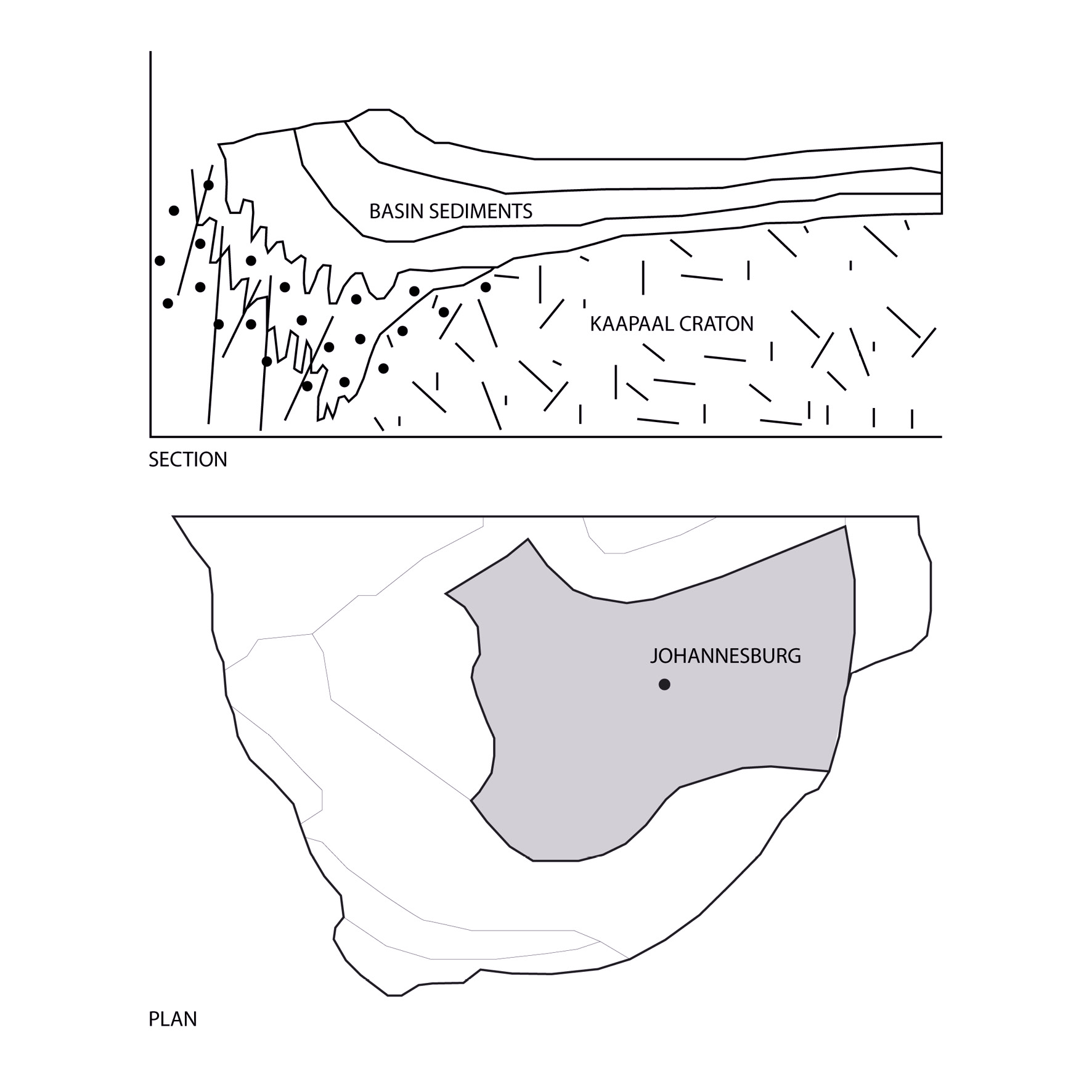
Image source:
Jaclyn S. Baughman, Rebecca M. Flowers. Mesoproterozoic burial of the Kaapvaal craton, southern Africa during Rodinia supercontinent assembly from (U-Th)/He thermochronology, Earth and Planetary Science Letters. 2020. Modified by NA.
References
1. Lemmons, Richard. 2022. “Kaapvaal Craton South Africa - Plate Tectonics.” Climate Policy Watcher. January 7, 2022. https://www.climate-policy-watcher.org/plate-tectonics/kaapvaal-craton-south-africa.html.
1. Lemmons, Richard. 2022. “Kaapvaal Craton South Africa - Plate Tectonics.” Climate Policy Watcher. January 7, 2022. https://www.climate-policy-watcher.org/plate-tectonics/kaapvaal-craton-south-africa.html.