Lesotho Water Project
“
—
”
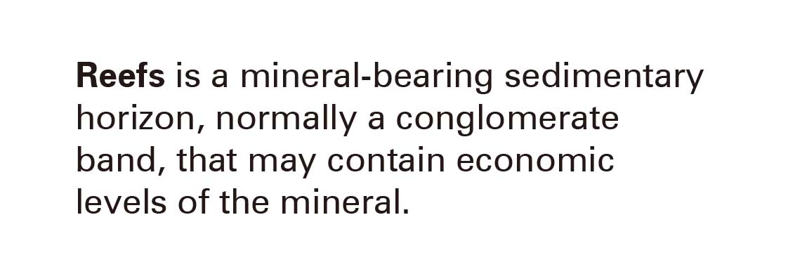
Intense formative geological events from over two billion years ago set the stage for the contamination and pollution of the groundwater and surface water supply in Johannesburg. Extreme heat from the Vredefort Dome asteroid impact not only created the gold that would become the focus of the 1886 Witwatersrand Gold Rush but also large amounts of uranium. These gold and uranium deposits are mostly found in reefs![]() : within their original rock hosts. Gold reef mining requires that the reefs are first blasted or broken into smaller rock chunks to access the gold deposits. The leftover rock fragments and uranium would be discarded subsequently: without a clear use case for uranium until the nuclear arms race and nuclear energy developments during the Cold War, uranium extracts were only considered waste byproducts - referred to as tailings - that would be stored in large impoundments that now resemble artificial hills in the comparatively flat landscape of the Witwatersrand region. These tailings contribute to uranium contamination of the groundwater supply and surface water sources.
: within their original rock hosts. Gold reef mining requires that the reefs are first blasted or broken into smaller rock chunks to access the gold deposits. The leftover rock fragments and uranium would be discarded subsequently: without a clear use case for uranium until the nuclear arms race and nuclear energy developments during the Cold War, uranium extracts were only considered waste byproducts - referred to as tailings - that would be stored in large impoundments that now resemble artificial hills in the comparatively flat landscape of the Witwatersrand region. These tailings contribute to uranium contamination of the groundwater supply and surface water sources.
The contamination of the groundwater supply in Gauteng has necessitated sourcing water from other catchments![]() : the Lesotho Highlands Water Project - a series of dams, reservoirs, a hydroelectric plant and over 200km of tunnels - was conceived in 1986 to be a phased development to provide water to Gauteng while also generating hydroelectricity for the country of Lesotho. A treaty was signed between the Apartheid Government and Lesotho’s Constitutional Monarchy to co-develop and finance the scheme alongside the World Bank and European Union.1
: the Lesotho Highlands Water Project - a series of dams, reservoirs, a hydroelectric plant and over 200km of tunnels - was conceived in 1986 to be a phased development to provide water to Gauteng while also generating hydroelectricity for the country of Lesotho. A treaty was signed between the Apartheid Government and Lesotho’s Constitutional Monarchy to co-develop and finance the scheme alongside the World Bank and European Union.1
The mega project redirects water from the Sengu/Orange River in the Lesotho Highlands to Gauteng which currently receives most of its water supply from phase I of the project after its completion in 2003. Phase II is underway and is scheduled to be completed in 2027(delayed). The province’s future water supply is heavily reliant on completing the later phases of the project.
The water transferred via the Vaal River System supplies enough water for 26 million South Africans and up to 60% of the country’s economy, used for industry, irrigation, and mining applications. Up to 85,000 Lesotho residents benefit from the project through community development, private sector growth and electrical infrastructure, with royalties paid to Lesotho for the diverted water.2 Phase I featured the construction of the tallest dam in Africa - the 106 meter high Katse Dam on the Malibamatso River - the Matsoku weir and water collection tunnel on the Matsoku River, a 48 kilometer long water transfer tunnel from the Katse reservoir to the Muela hydroelectric power station in northern Lesotho, and a water delivery tunnel from Muela that empties into the Vaal River which empties into the Vaal Lake near Johannesburg. This water - pristine in its origin - travels from Lesotho to Johannesburg, uncontaminated by human surface operations and activities.

![]() Image source:
https://www.dw.com/en/lesotho-water-project-failed-to-cut-poverty-critics-say/a-16182680
Image source:
https://www.dw.com/en/lesotho-water-project-failed-to-cut-poverty-critics-say/a-16182680
 Image source:
https://www.dw.com/en/lesotho-water-project-failed-to-cut-poverty-critics-say/a-16182680
Image source:
https://www.dw.com/en/lesotho-water-project-failed-to-cut-poverty-critics-say/a-16182680
References
1. Lesotho Highlands Development Authority, http://www.lhda.org.ls/lhdaweb , Accessed on 23 March 2022
2. Development Bank South Africa, Lesotho Highlands Water Project Appraisal Report, DBSA, May 2021, page 7, https://www.afdb.org/en/documents/south-africa-lesotho-highlands-water-project-lhwp-phase-ii-project-appraisal-report
3. Winde, Frank, Peter Wade, and Izak Jacobus Van der Walt. 2004. “Gold Tailings as a Source of Waterborne Uranium Contamination of Streams - the Koekemoerspruit (Klerksdorp Goldfield, South Africa) as a Case Study - Part I of III: Uranium Migration along the Aqueous Pathway.” Water SA 30 (2): 219–25. https://doi.org/10.4314/wsa.v30i2.5067.
4. Winde, Frank, Gerhard Geipel, Carolina Espina, and Joachim Schüz. 2019. “Human Exposure to Uranium in South African Gold Mining Areas Using Barber-Based Hair Sampling.” PLOS ONE 14 (6): e0219059. https://doi.org/10.1371/journal.pone.0219059.
5. “Is Johannesburg the Most Radioactive City in the World?” n.d. Accessed February 27, 2022. https://www.polity.org.za/article/is-johannesburg-the-most-radioactive-city-in-the-world-2021-02-16.
6. “OurStory | LHDA.” n.d. Accessed February 27, 2022. http://www.lhda.org.ls/lhdaweb/about/ourStory.
7. Balch, Oliver. 2015. “Radioactive City: How Johannesburg’s Townships Are Paying for Its Mining Past.” The Guardian, July 6, 2015, sec. Cities. https://www.theguardian.com/cities/2015/jul/06/radioactive-city-how-johannesburgs-townships-are-paying-for-its-mining-past.
8. Simpson, P. R., and J. F. W. Bowles. 1977. “Uranium Mineralization of the Witwatersrand and Dominion Reef Systems.” Philosophical Transactions of the Royal Society of London. Series A, Mathematical and Physical Sciences 286 (1336): 527–48.
9. Winde, F., and L. A. Sandham. 2004. “Uranium Pollution of South African Streams - An Overview of the Situation in Gold Mining Areas of the Witwatersrand.” GeoJournal 61 (2): 131–49.
10. Heath, Steven. n.d. “The Highlands Water Project in Lesotho - Water Supply and Hydroelectricity.” https://www.thegeographeronline.net/uploads/2/6/6/2/26629356/water_source_case_study.pdf.