Fischer Landfill
![]()
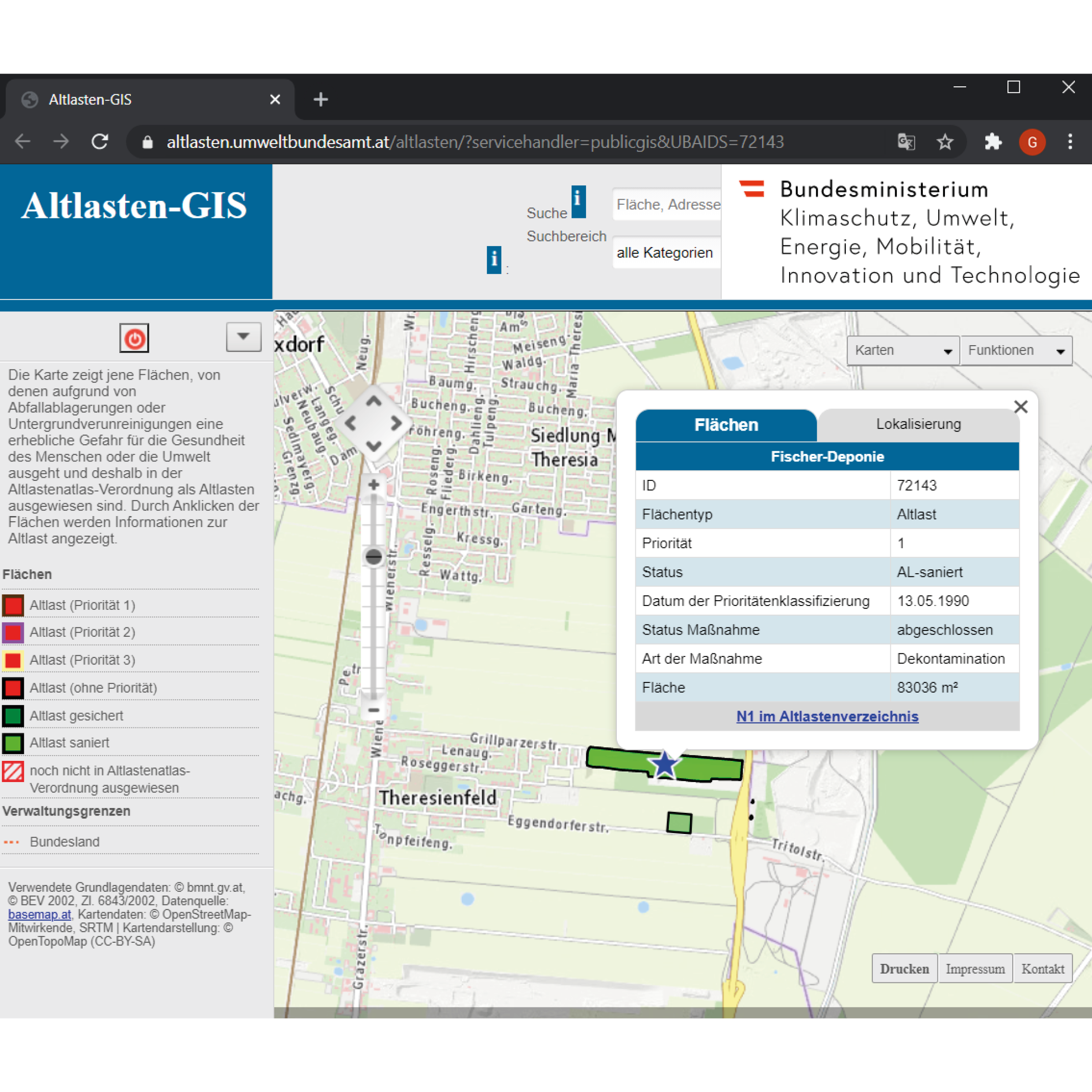
The atlas of the contaminated sites is to provide maps that illustrate the areas of waste deposits or subsurface contamination that threaten either the human health or the environment. Contaminated areas are mapped and listed with their unique ID, priority, status, area, and location. The question now arises: could the contamination be restricted to a limited circumscribed area?
The example of Fischer-Deponie - ID:72143, an area located in the agricultural area of Theresienfeld suggest a paradigm of subsurface contamination but also of groundwater contamination. The landfill was created from a gravel pit in the well drained-bed of the Mitterndorfer Senke, one of the largest reservoirs in Central Europe. However, around 550,000 cubic meters of various types of waste were deposited in an area of around 70,000 square meters without any measures to protect the groundwater. In 1972 the Waxina company deposited poisonous barrels and the latter tenant Johann Fischer, industrial and commercial waste. The operations were taking place from 1972 until 1987, when the authorities managed to enforce the final closure and rehabilitation of the landfill.
Groundwater investigations revealed significantly higher levels of chlorinated hydrocarbons (especially 1,1,1-trichloroethane and trichloroethene) and aromatic hydrocarbons. The massive contamination of the groundwater affected a groundwater body that plays a vital role in the drinking water supply in Easte Austria. Thus, a row of barrage wells was built to treat the extracted groundwater.
The subsoil in the area of the contaminated site is made up of well-drained, Quaternary gravel, which is partially solidified. In the depth of 20 to 25 m, there is a slightly permeable, fine-grained sediment layer, a low-permeability intermediate layer. The groundwater, over the entire length of the dump flows over this layer. The groundwater in the immediate outflow is collected by means of a barrier well and, after cleaning, is drained away again further downstream. A waterworks upstream of the Fischer landfill has been partially shut down due to the supra-regional pollution of the groundwater. The former old deposit is currently not in use.
As a result of the pollution that has already occurred, water supply systems in the area of the Mitterndorfer Basin had to be abandoned. The Fischer landfill, as one of the causes of groundwater pollution, posed an acute threat to a groundwater resource of supraregional importance. The old deposit posed a significant threat to the environment and was to be assessed as a contaminated site in the sense of the ALSAG.
In 2007, after procedures of redevelopment and renovation by the company BALSA GmbH, the Fischer landfill assessed renovated since the remediation foals have been fully achieved and that there are no longer any significant effects on the protected groundwater from the former Fischer landfill and are not expected in the future.
← Back to Lexicon
The atlas of the contaminated sites illustrating the location of Fischer Landfill and the tab of its information.
Sources:https://altlasten.umweltbundesamt.at/altlasten/?servicehandler=publicgis&UBAIDS=72143
Sources:https://altlasten.umweltbundesamt.at/altlasten/?servicehandler=publicgis&UBAIDS=72143