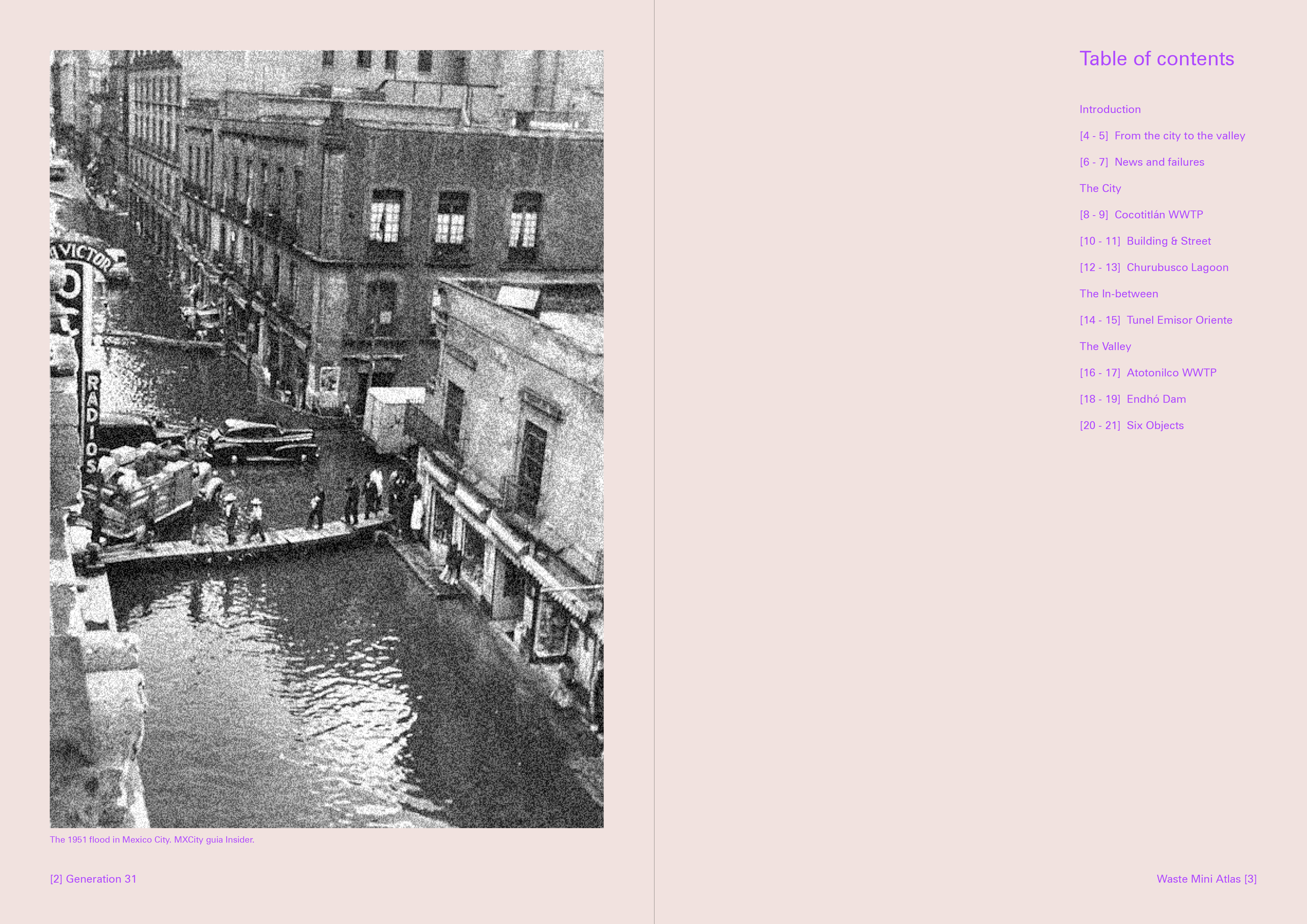
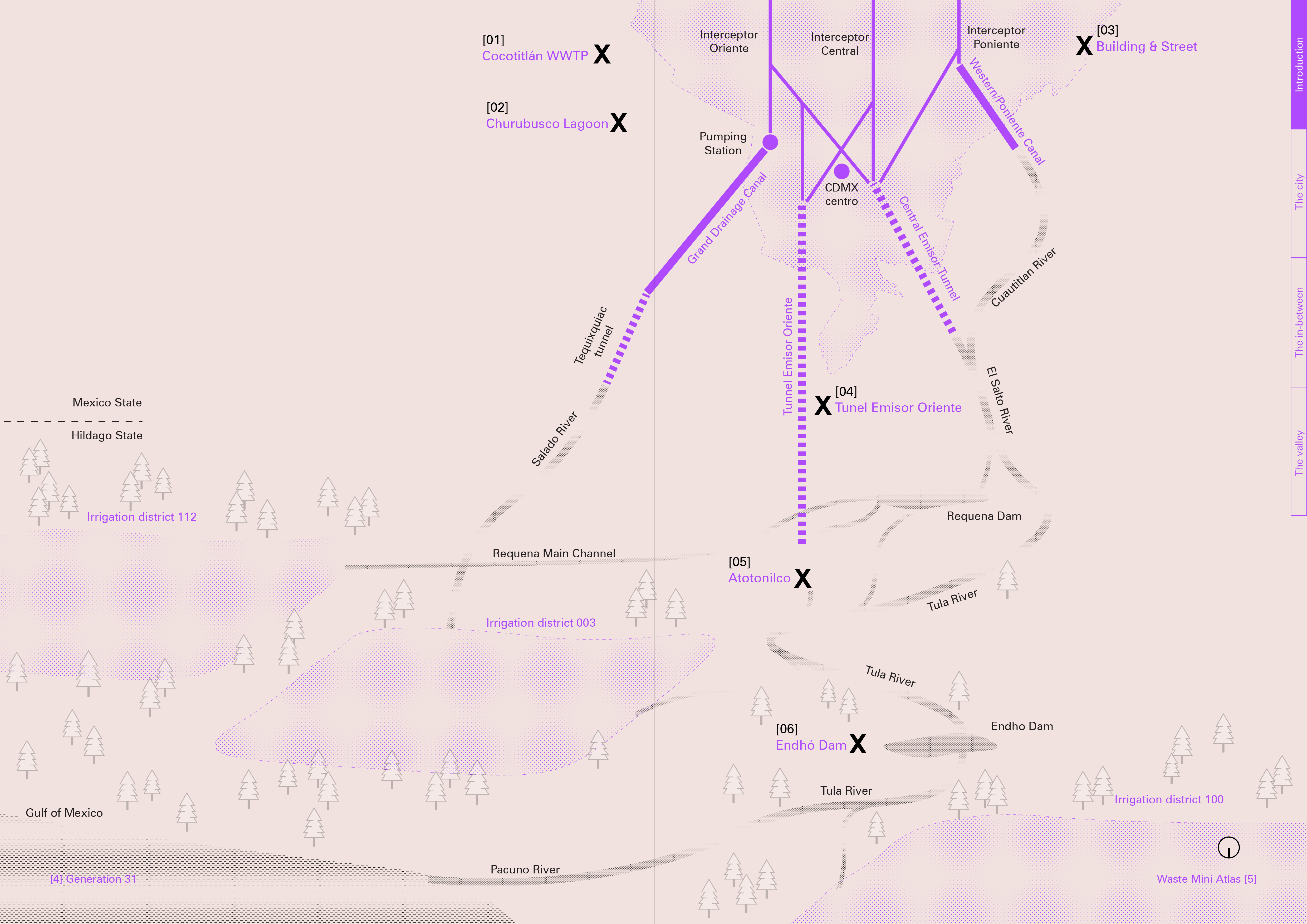
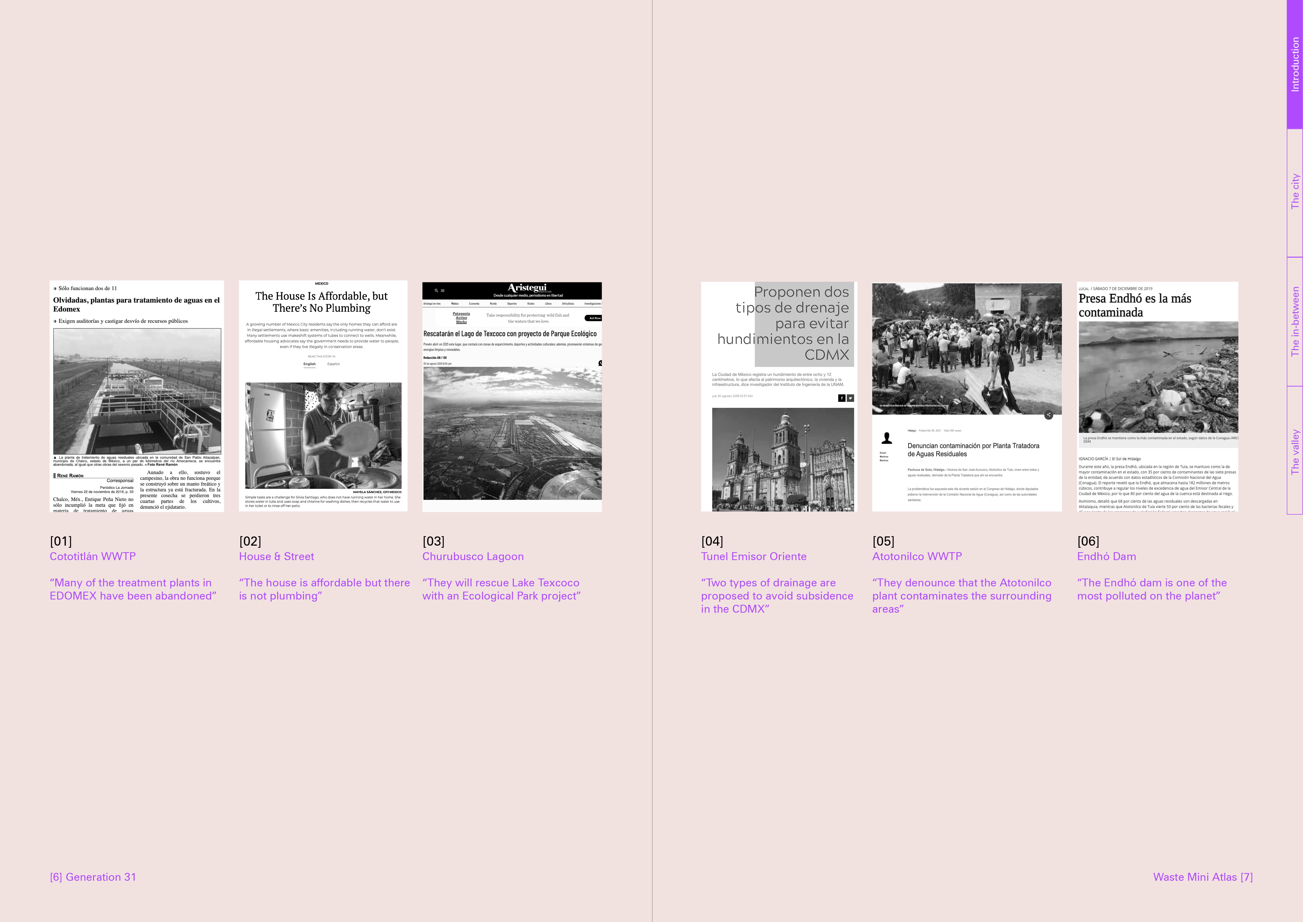
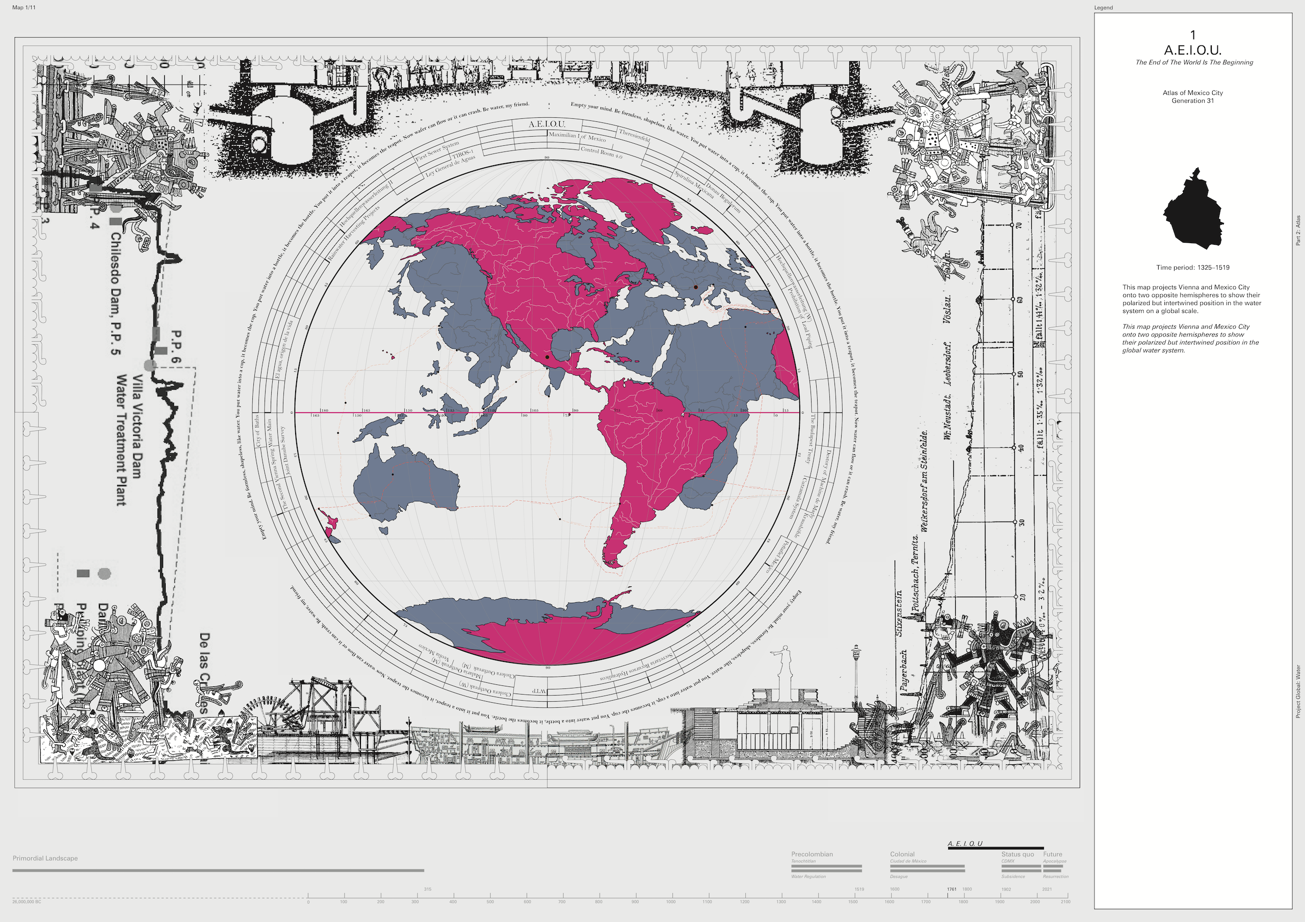
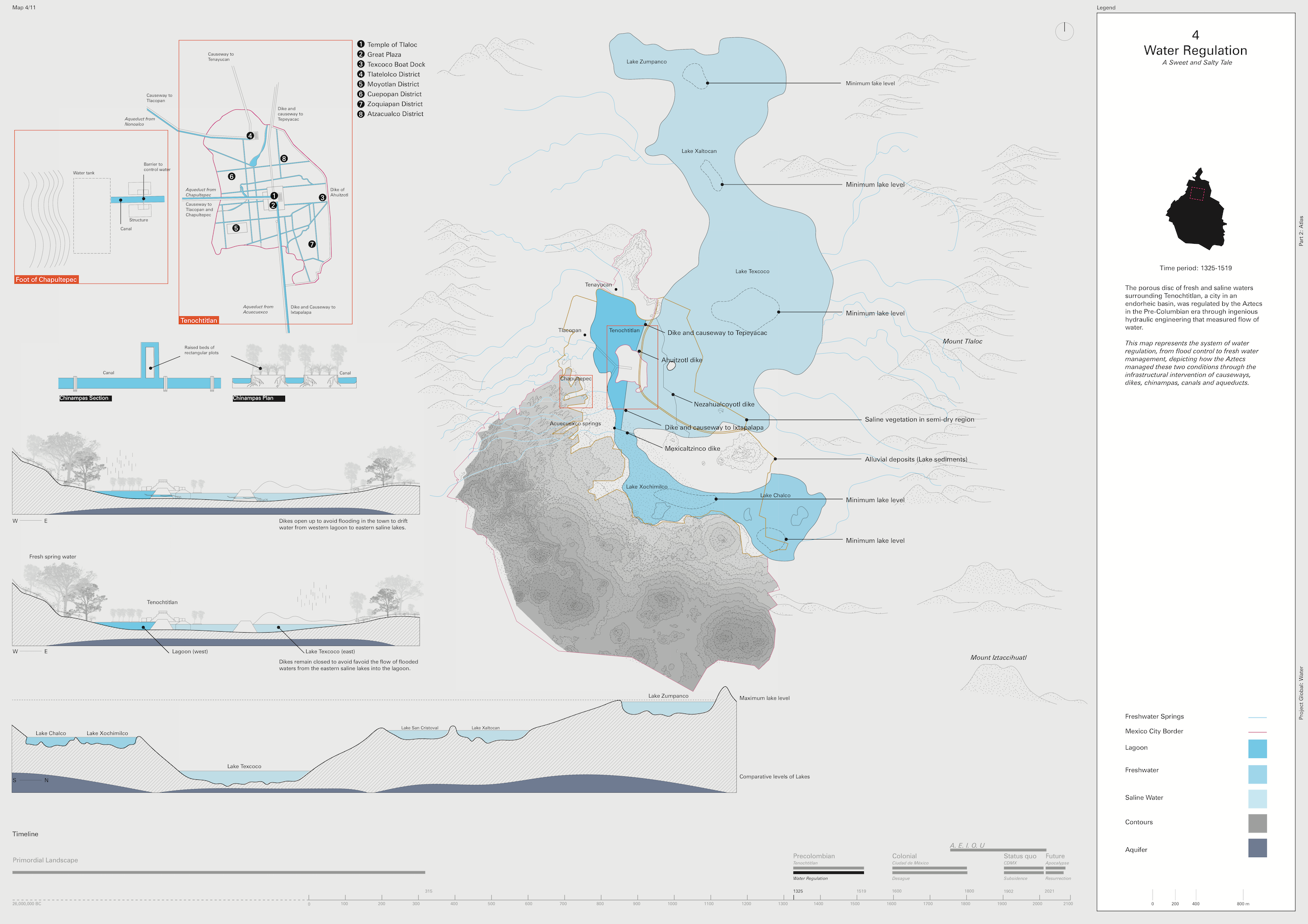
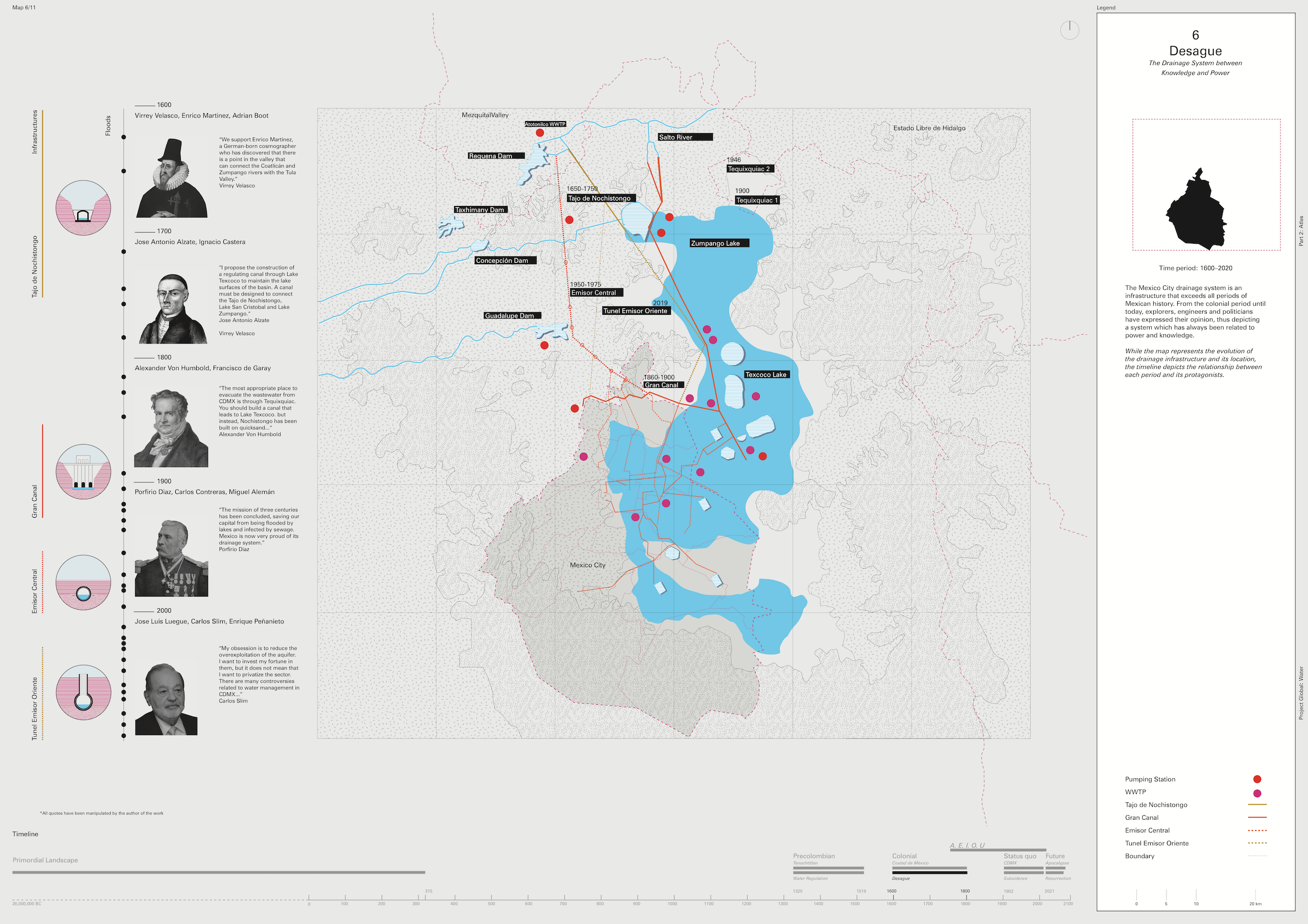
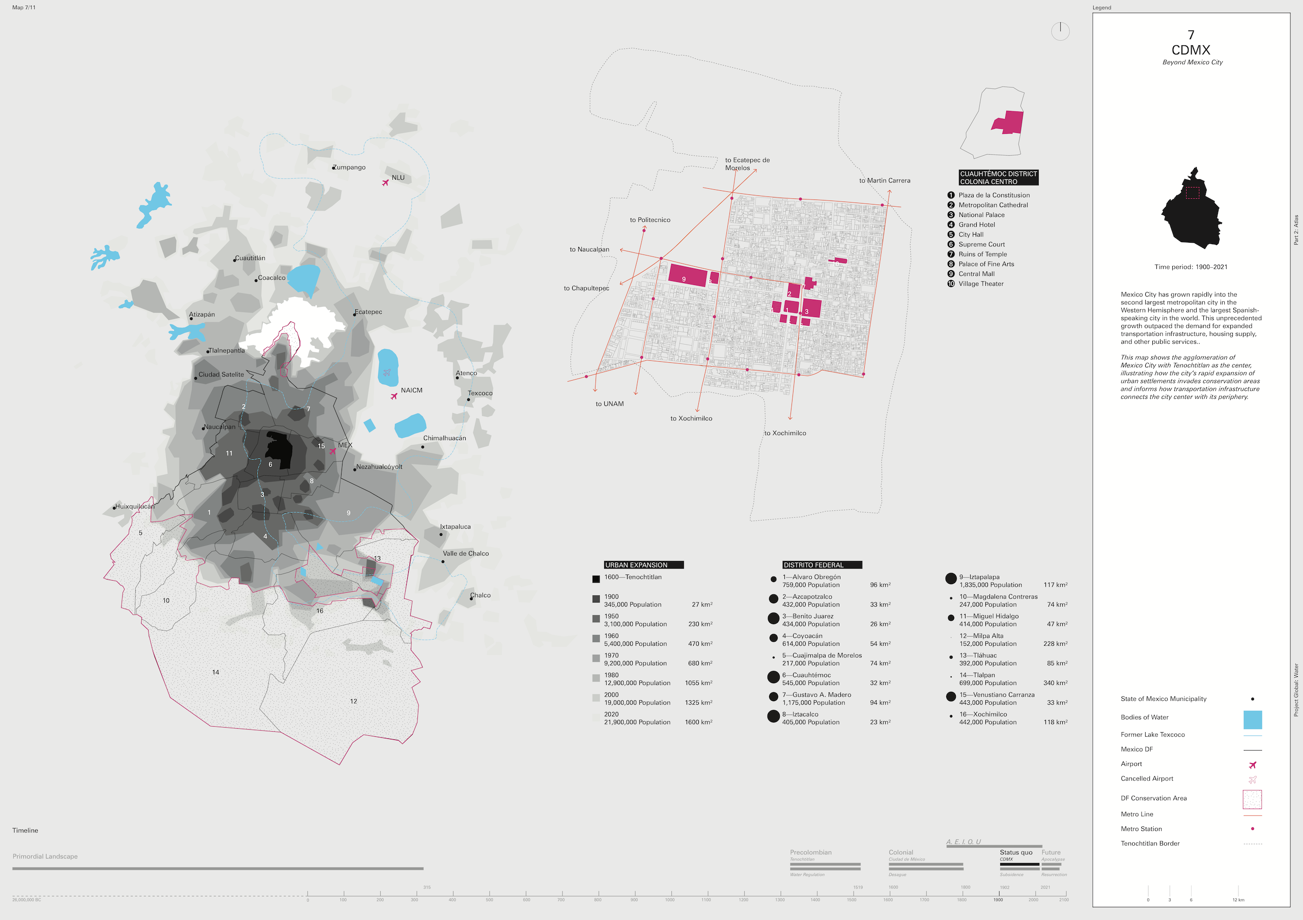
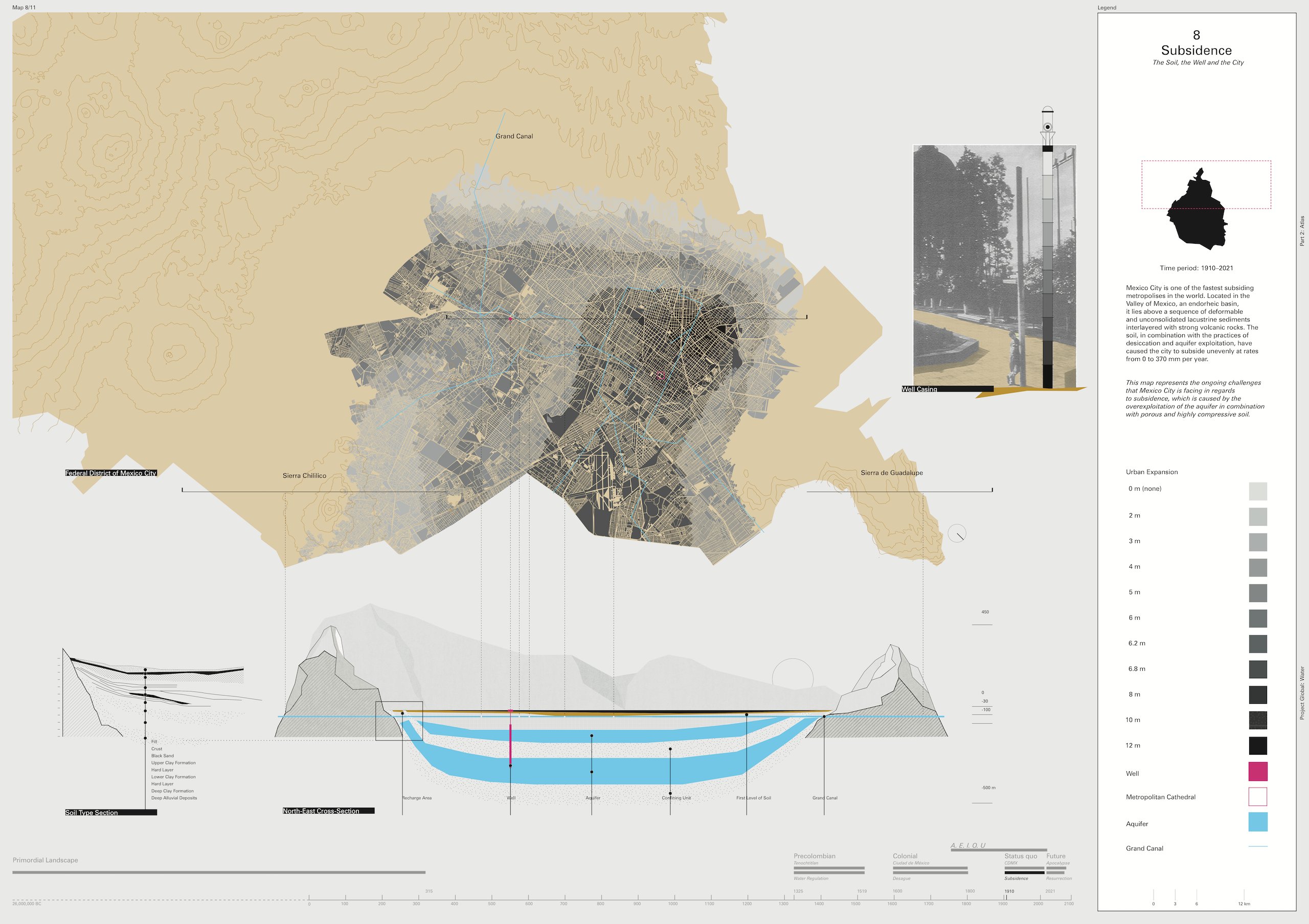
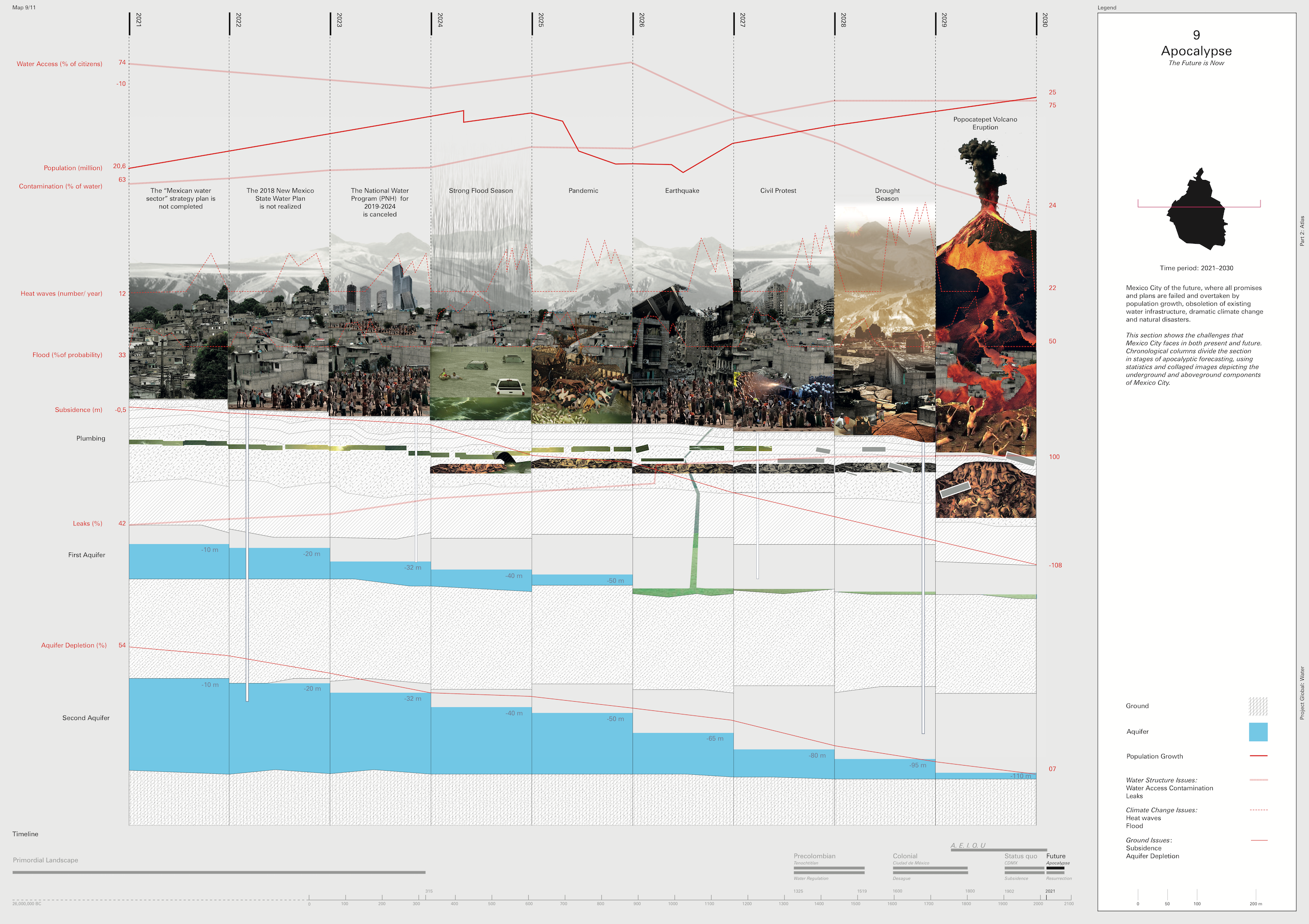
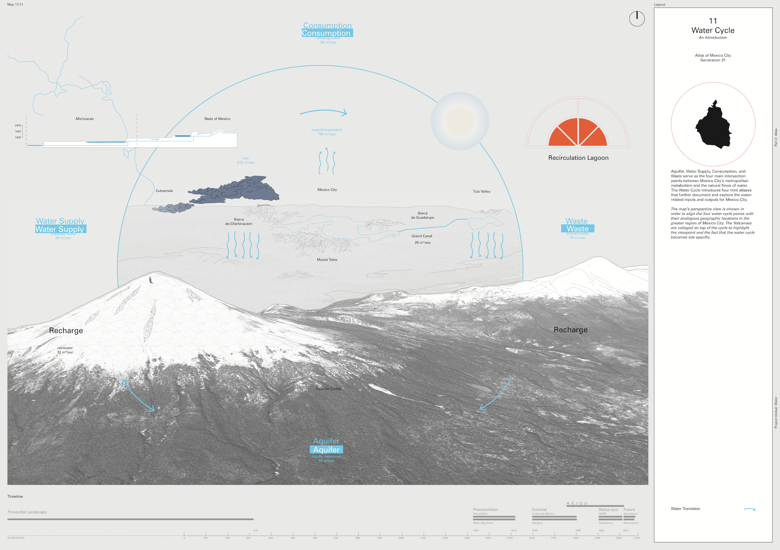
11 maps of Mexico and 4 mini atlases related to the Water Cycle relate the principles -as documented in the Lexicon- to the specific geographical, social and cultural characteristics of Mexico City and the surrounding territory. From the ancient altepetl to the 2021 9thlargest metropolitan area in the world, the Valley of Mexico has always been dominated by water issues throughout history. The aquifer, along with the water supply, consumption and waste remain the four main reference points that inject the metropolitan metabolism to the natural flows of water.
11 Maps
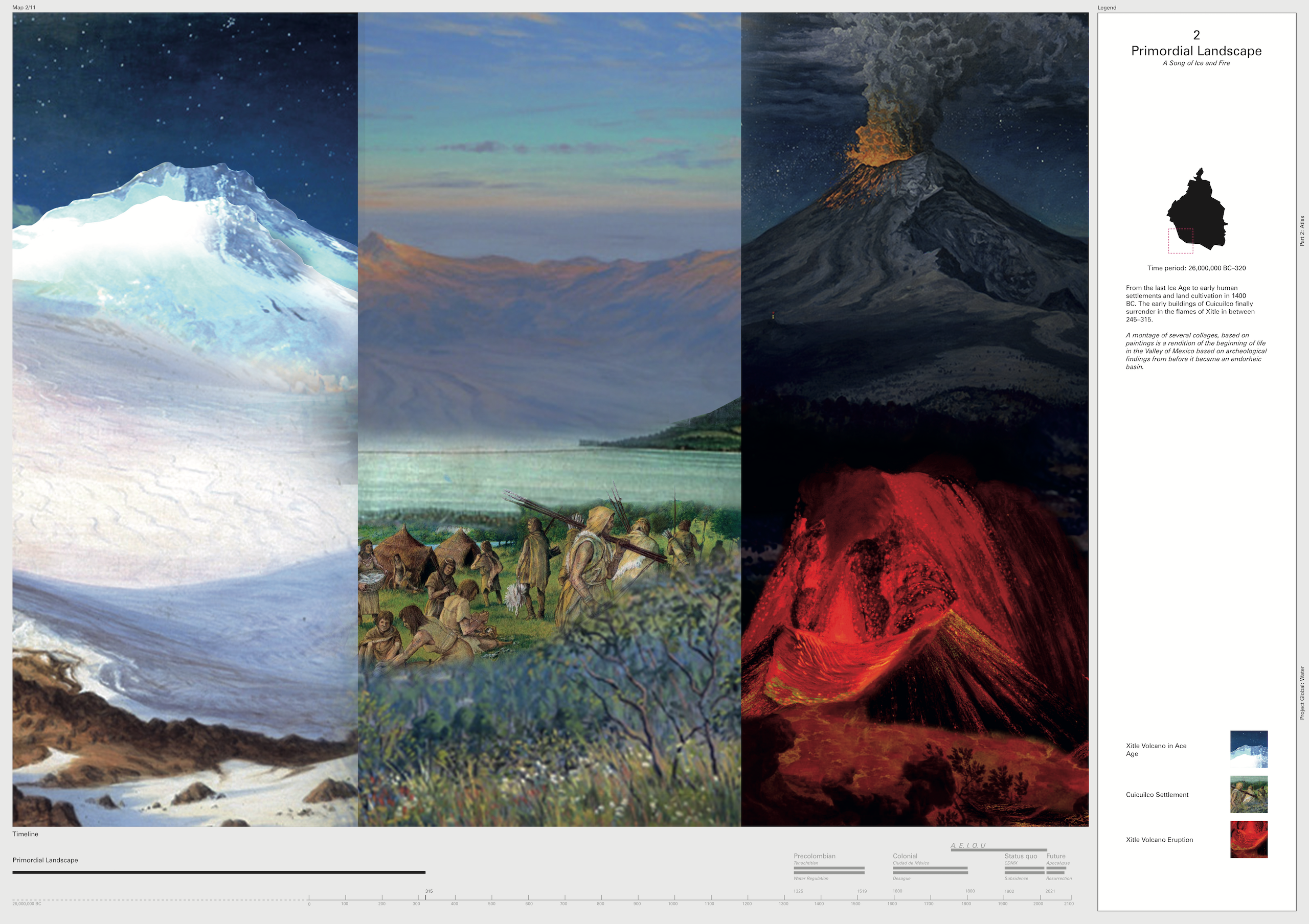
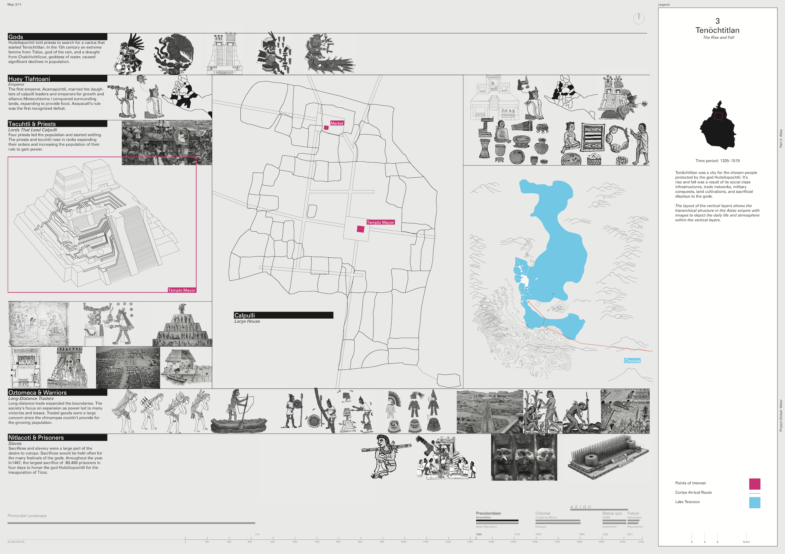
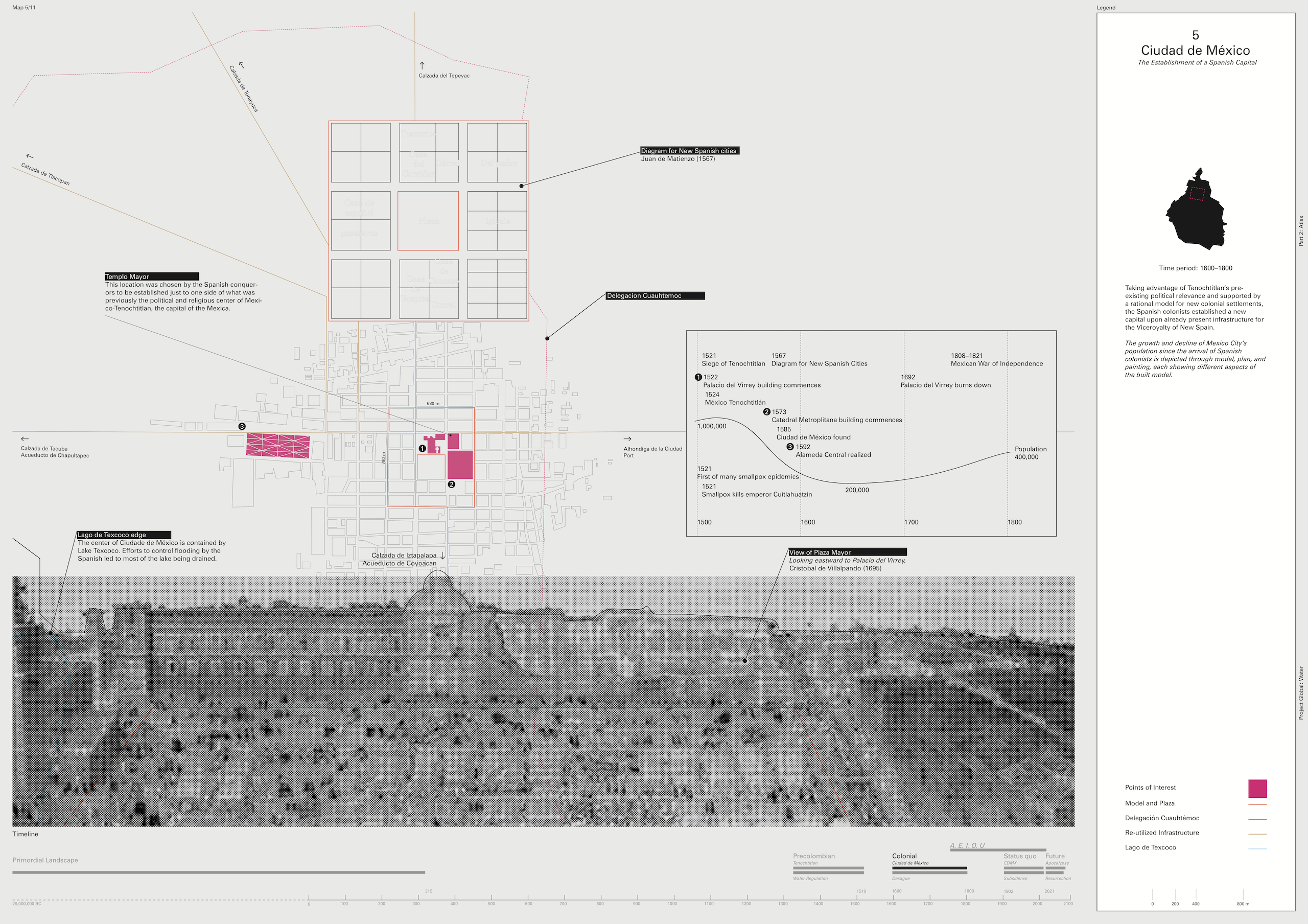
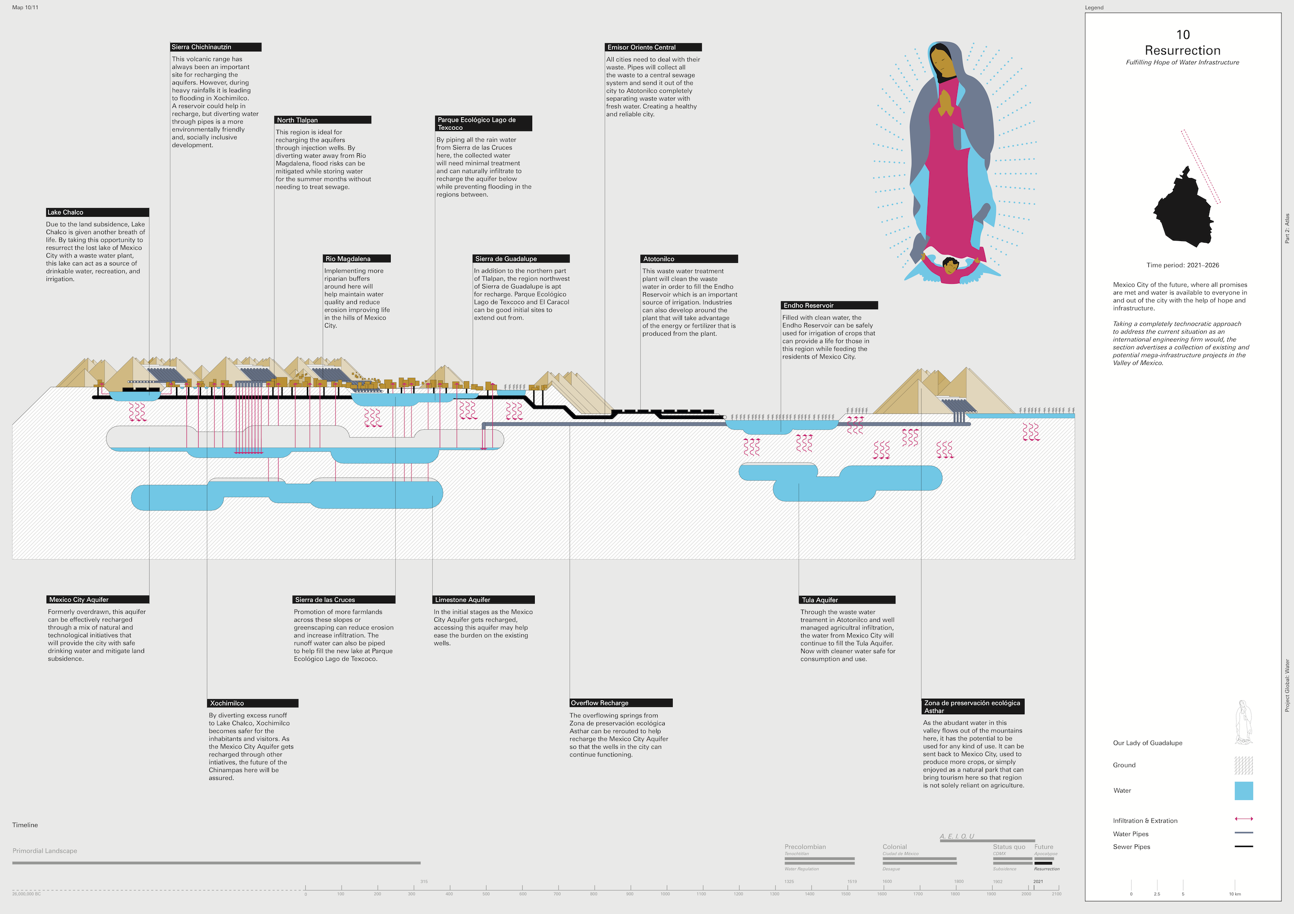
If the end of the world marks a new beginning, the 11 maps interrelate the rise and fall of the Aztecs civilization to the soil, the wells and the contemporary metropolis, going beyond Mexico City. The work, starting from the primordial landscape of the Valley of Mexico, addresses the history, explores the current situation, and reflects on the possible futures of Mexico City and the surrounding area.
Mini Atlas
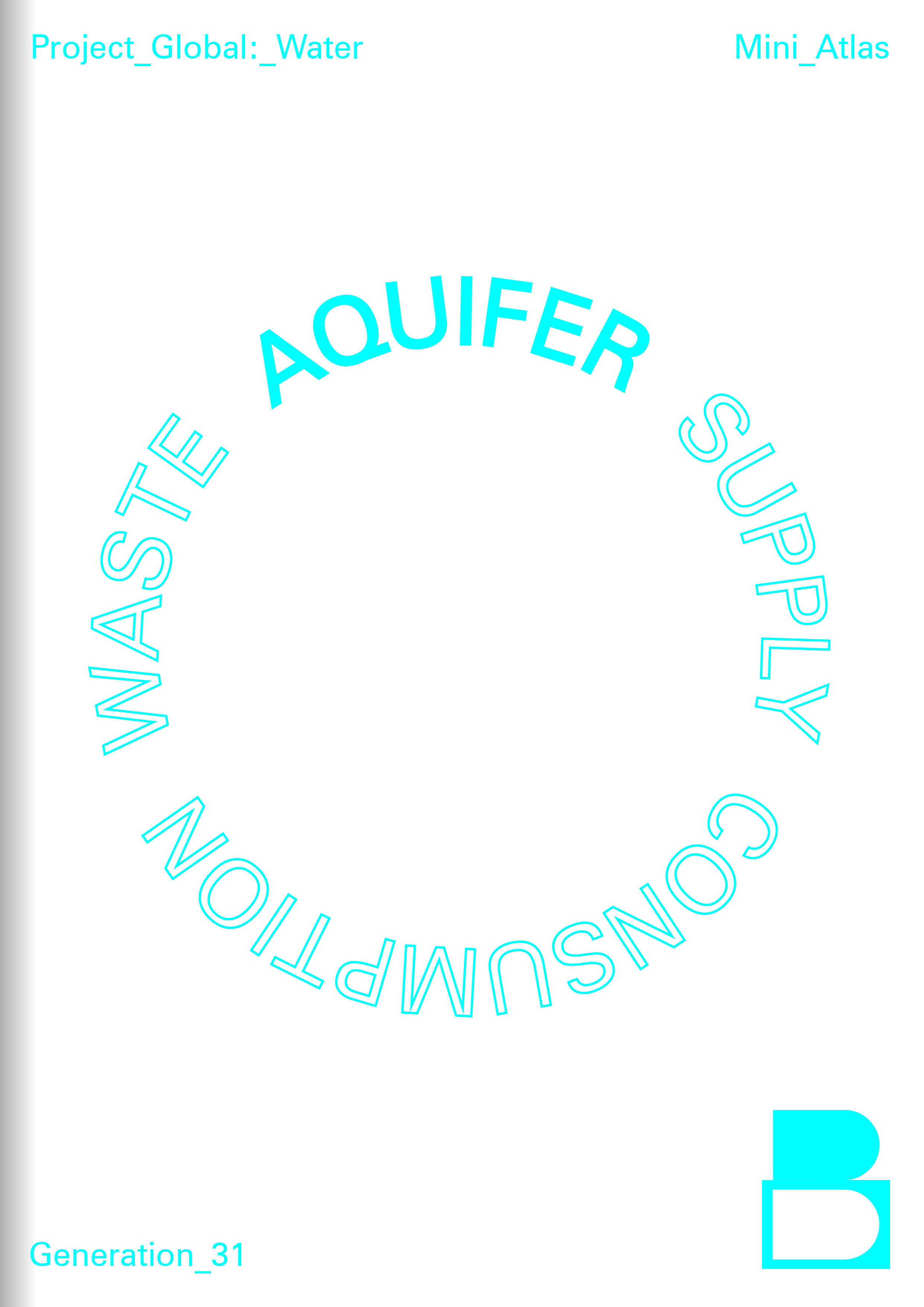
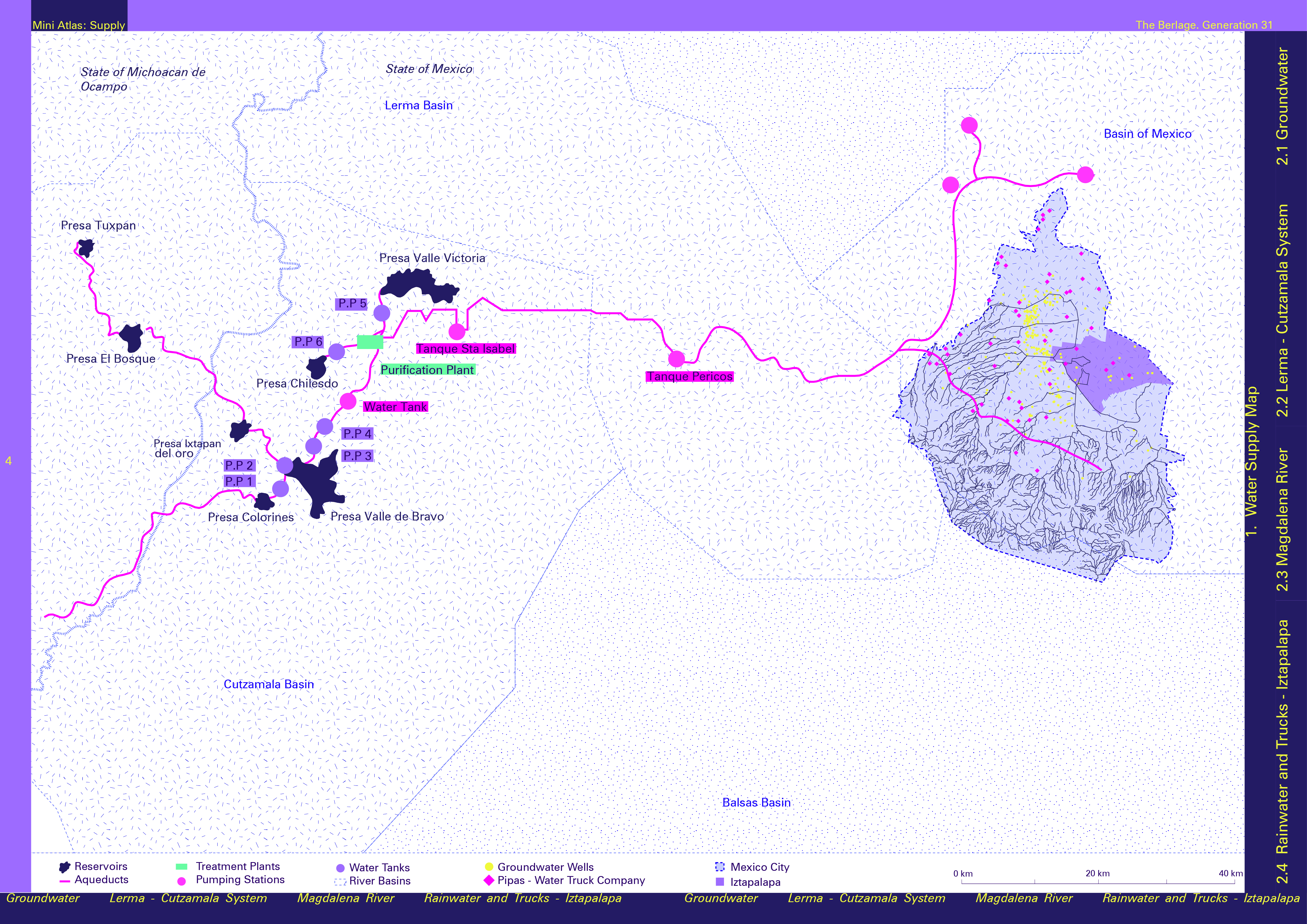
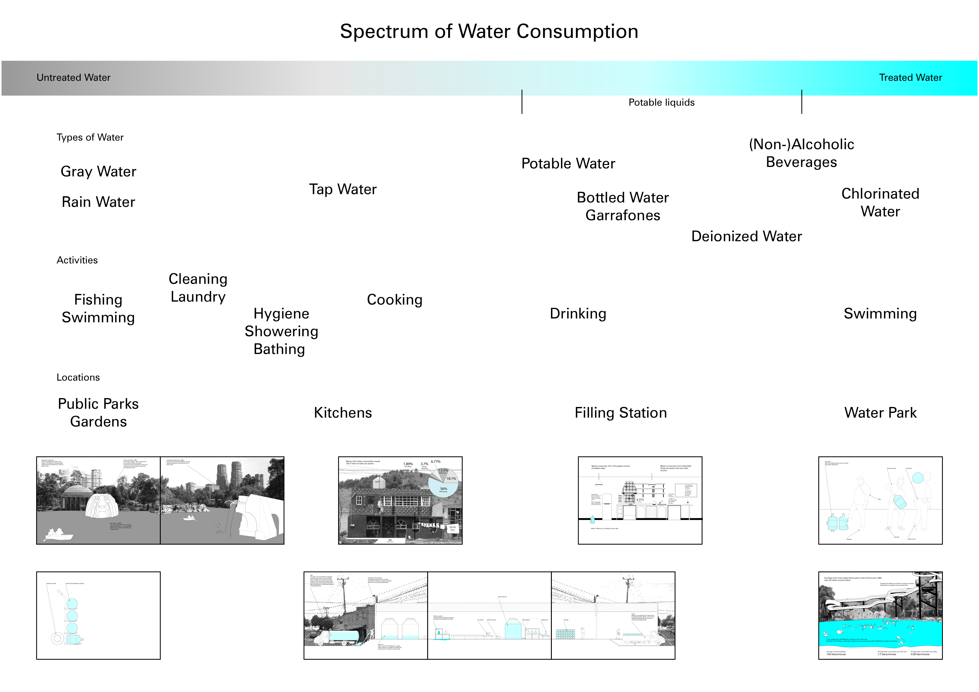
The water related inputs and outputs for the metropolitan metabolism are broken down to 4 categories: aquifer, water supply, consumption and waste, composing Mexico City’s water cycle. 4 mini atlases explore these stages and formulate site-specific questions, relevant to water issues, that will serve as starting points for a set of architectural projects.
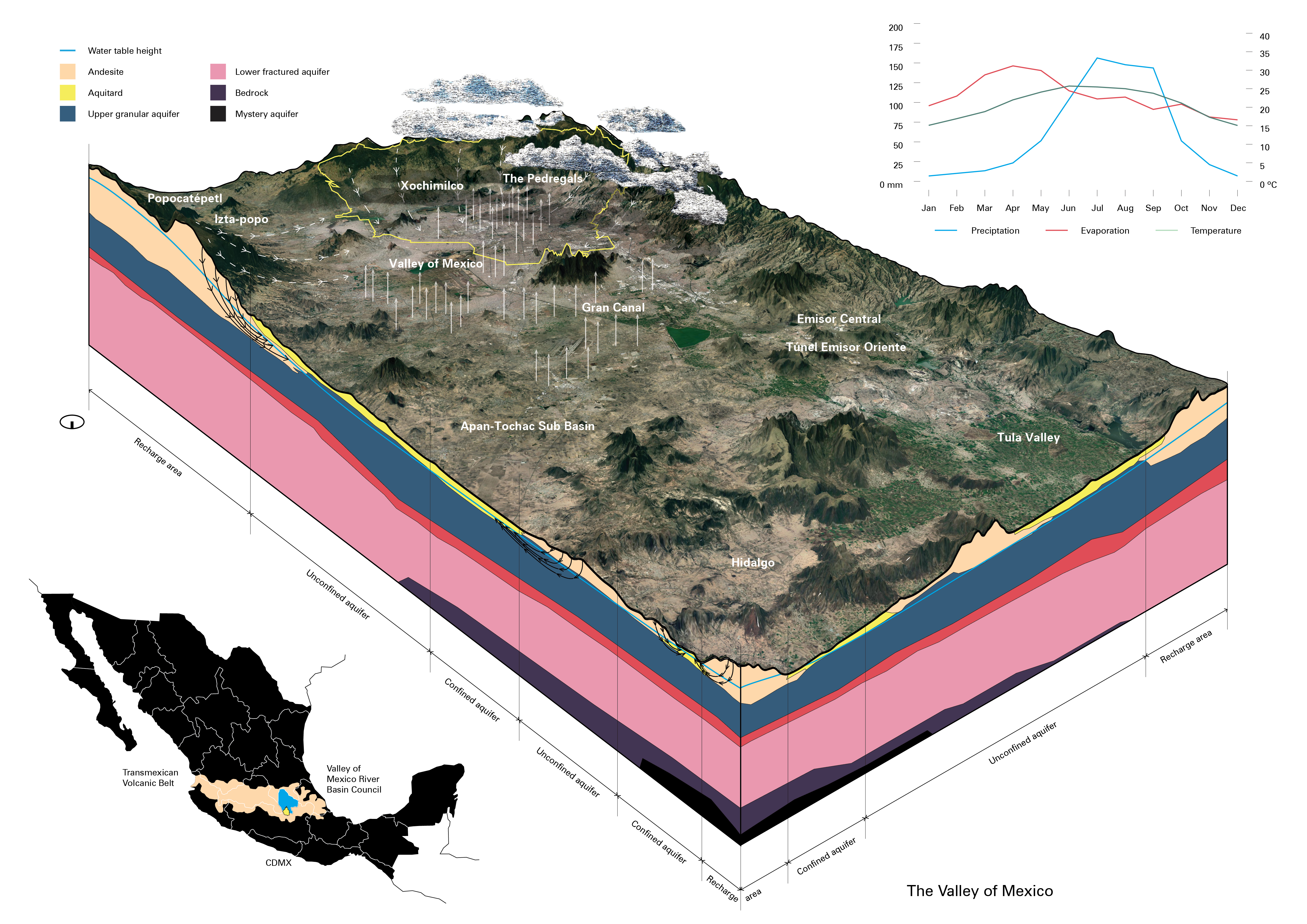
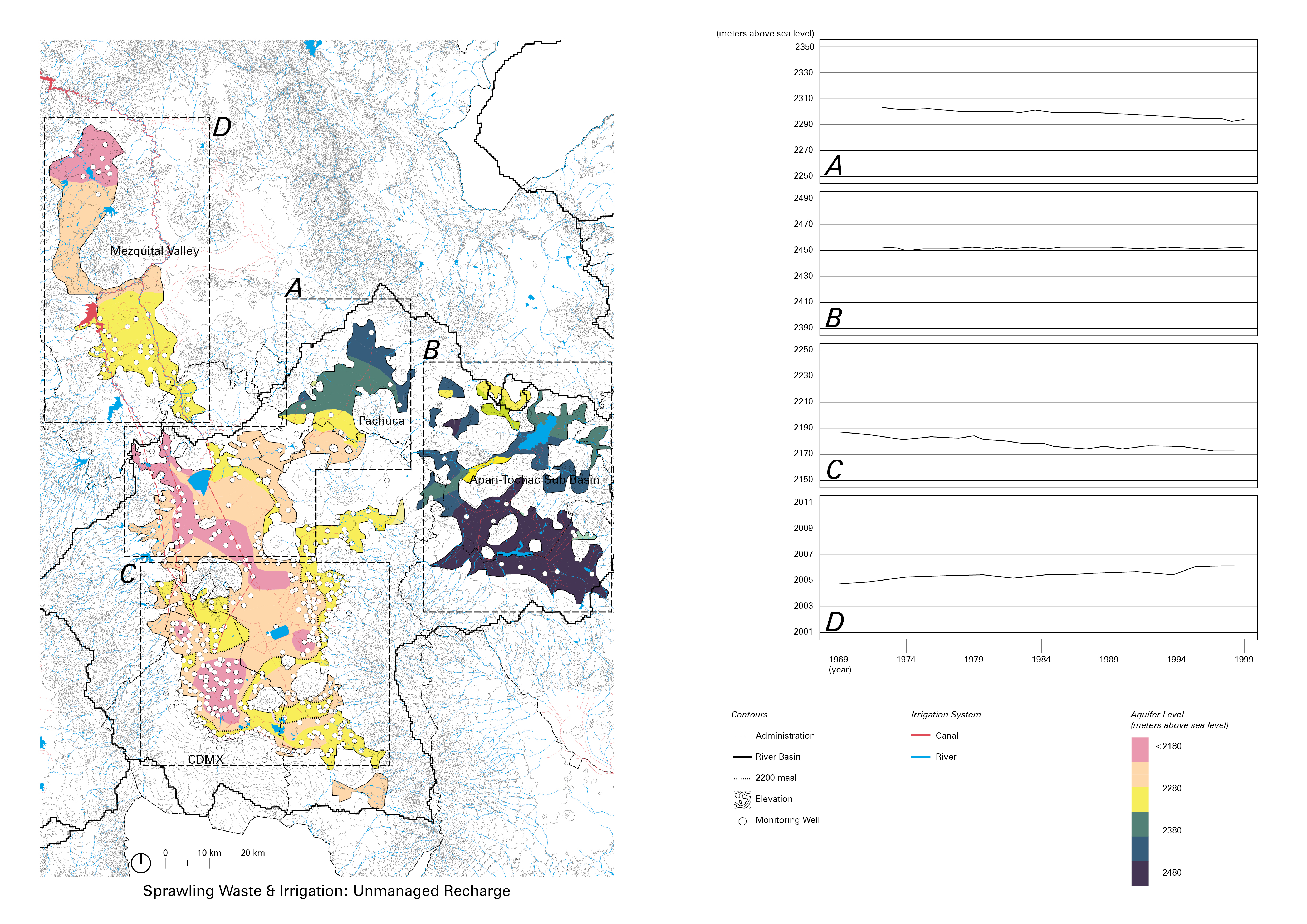
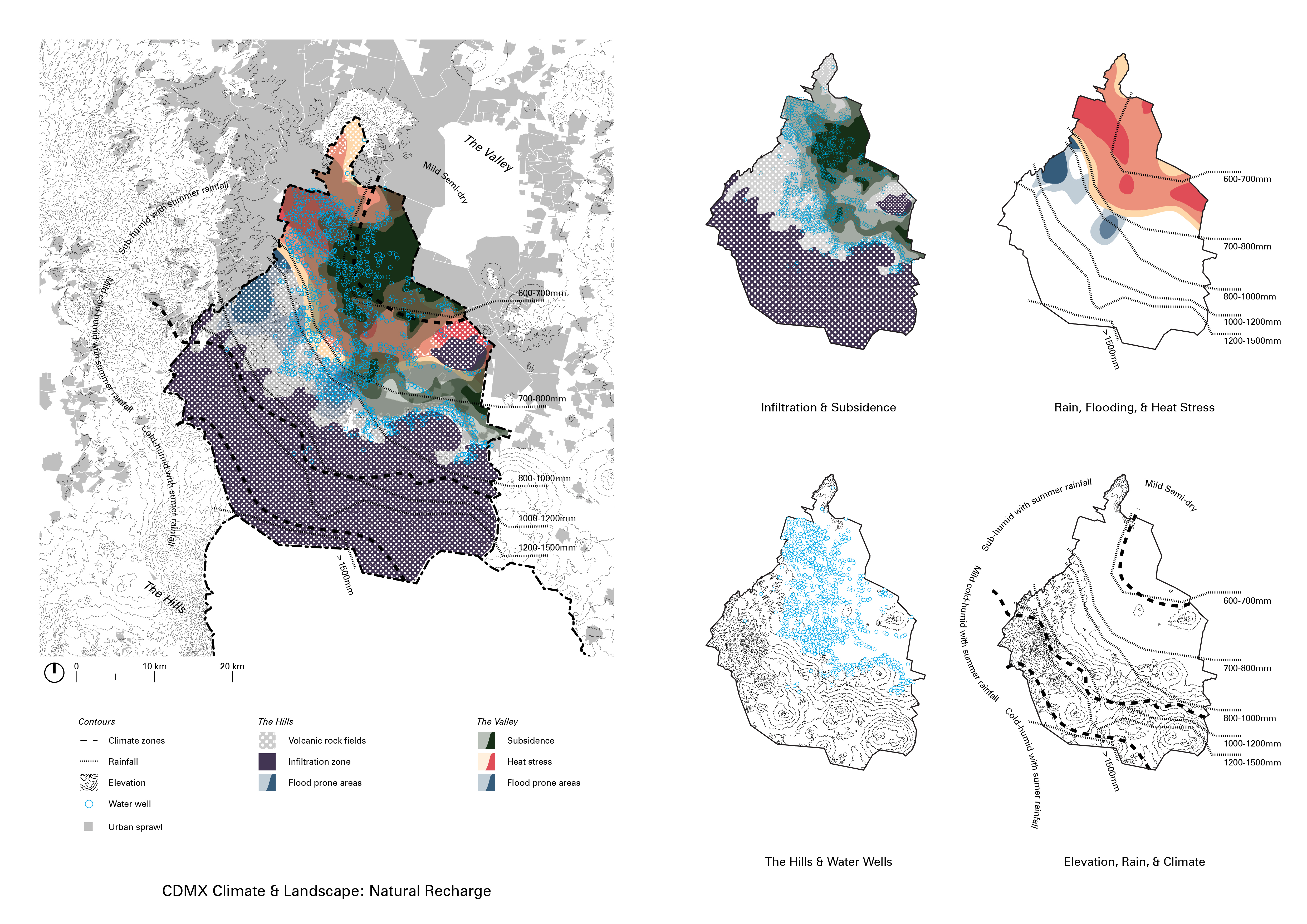
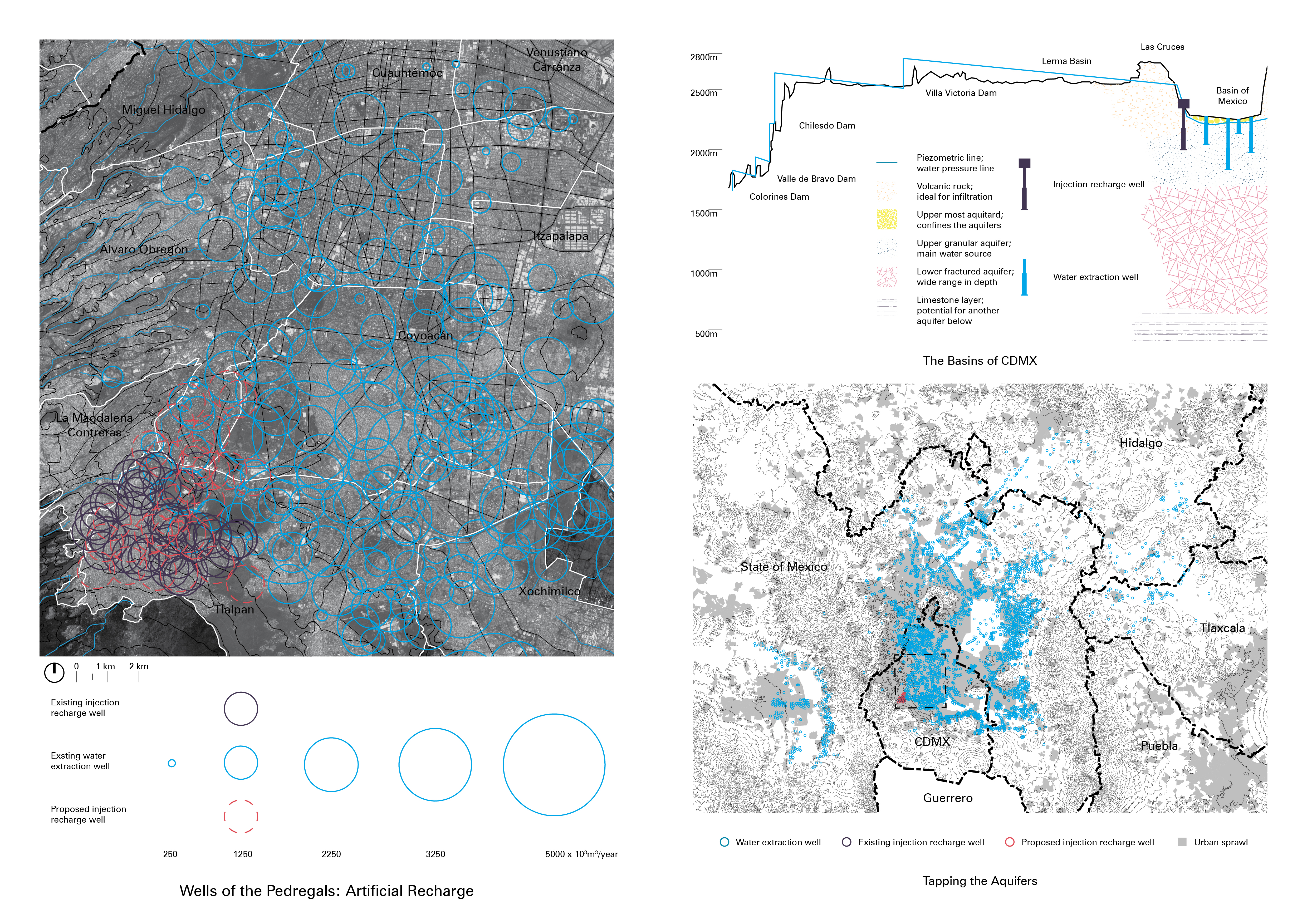
Aquifer
![]()
![]()
![]()
![]()
![]()
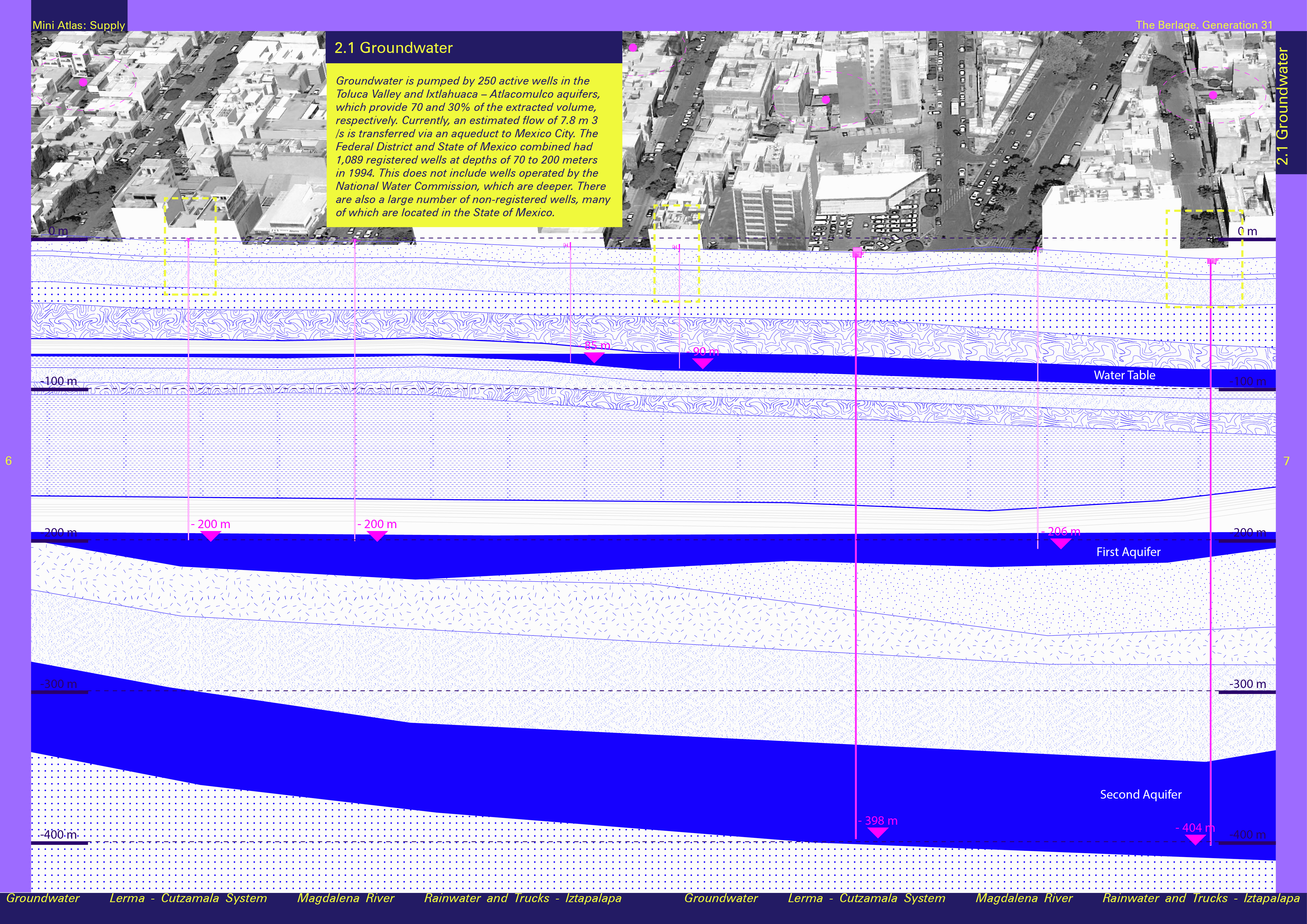
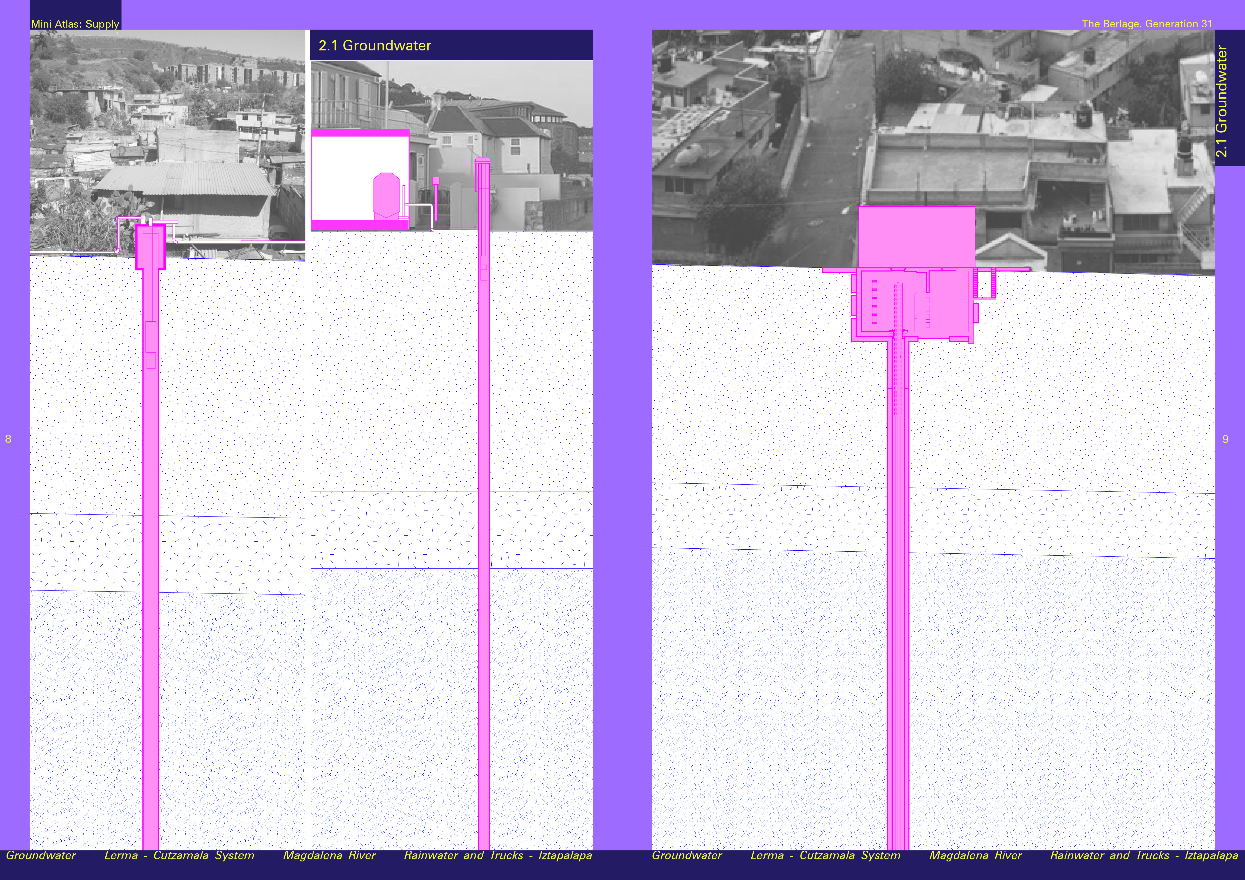
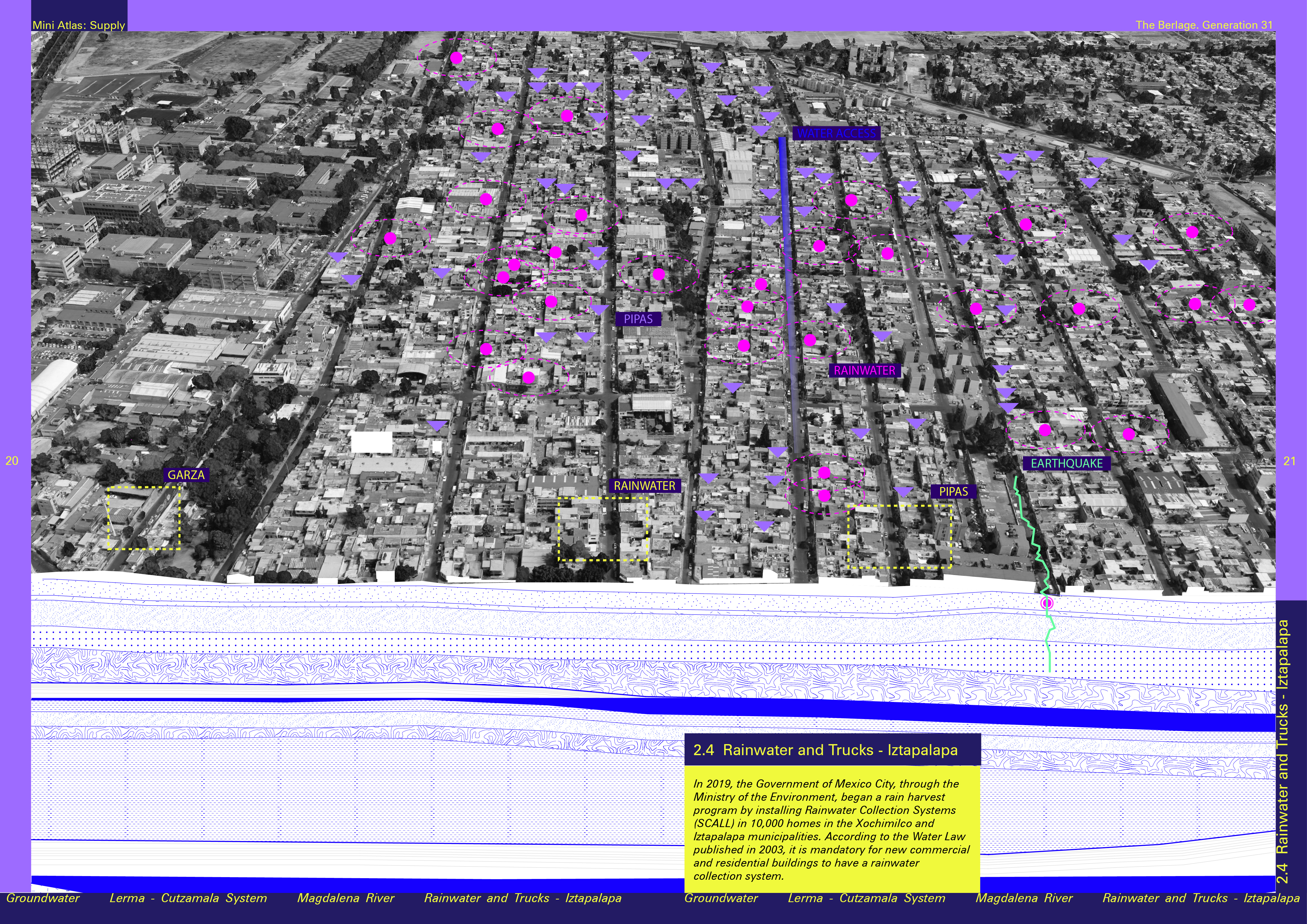
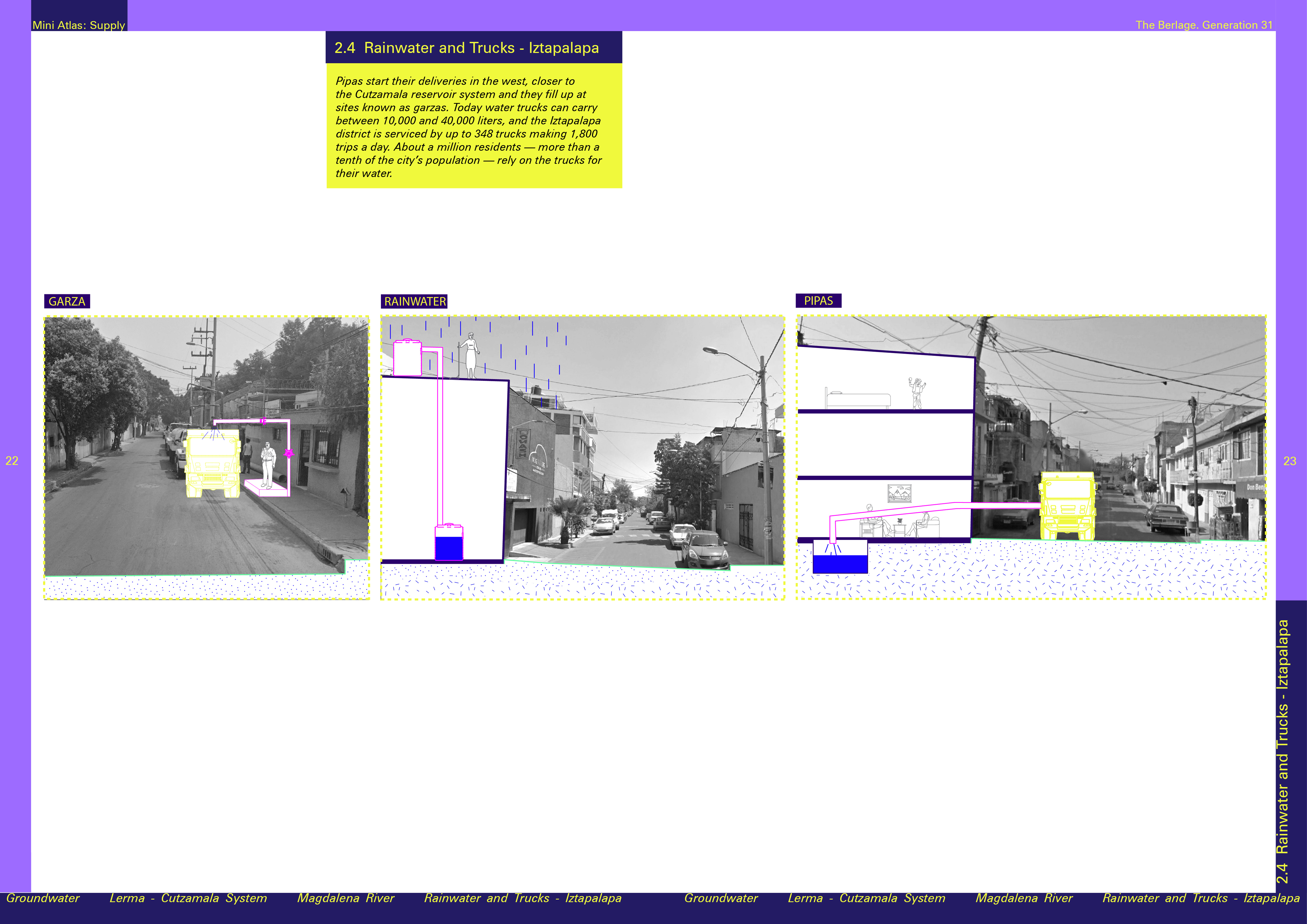
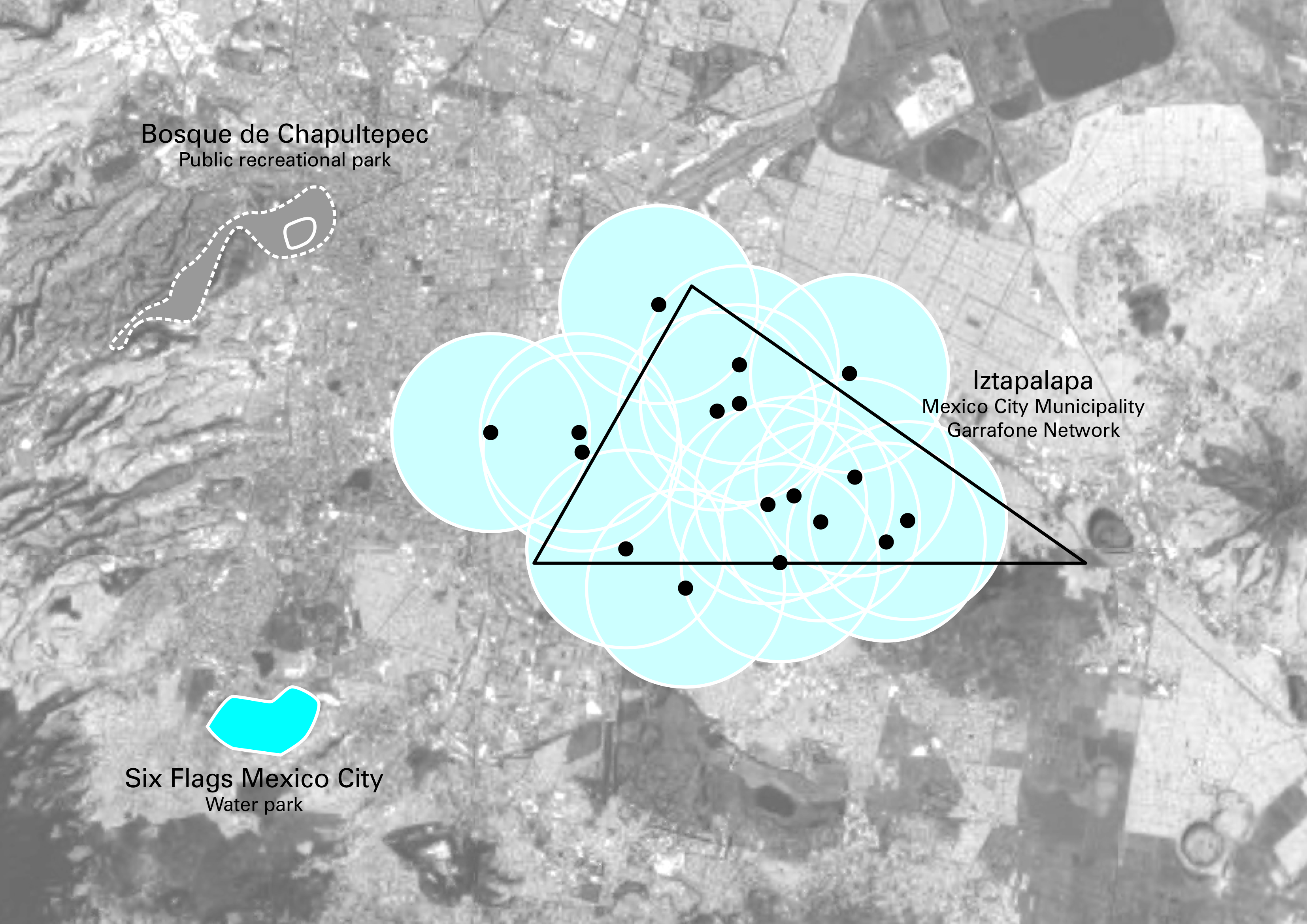
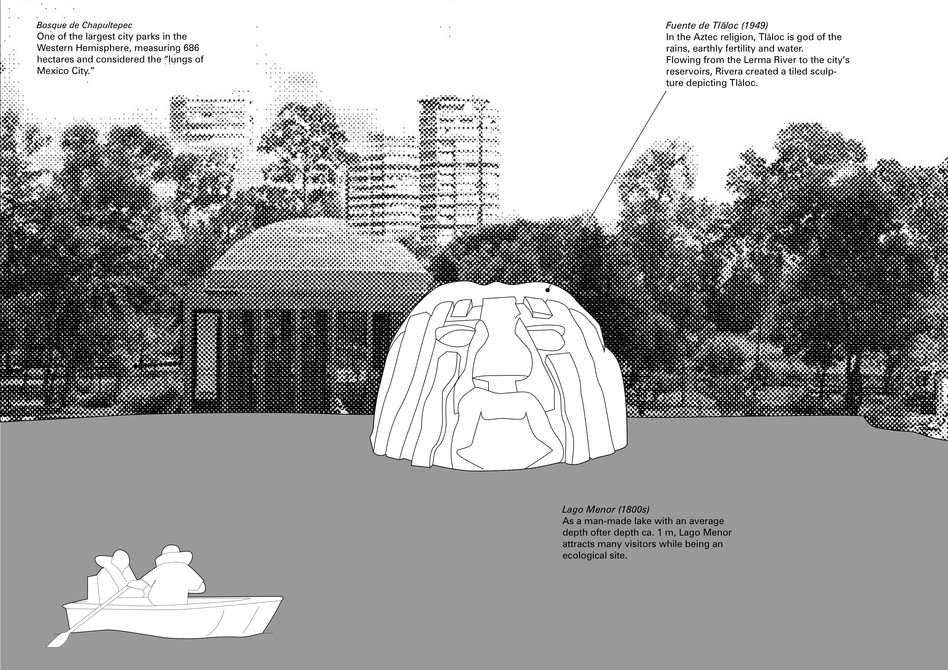
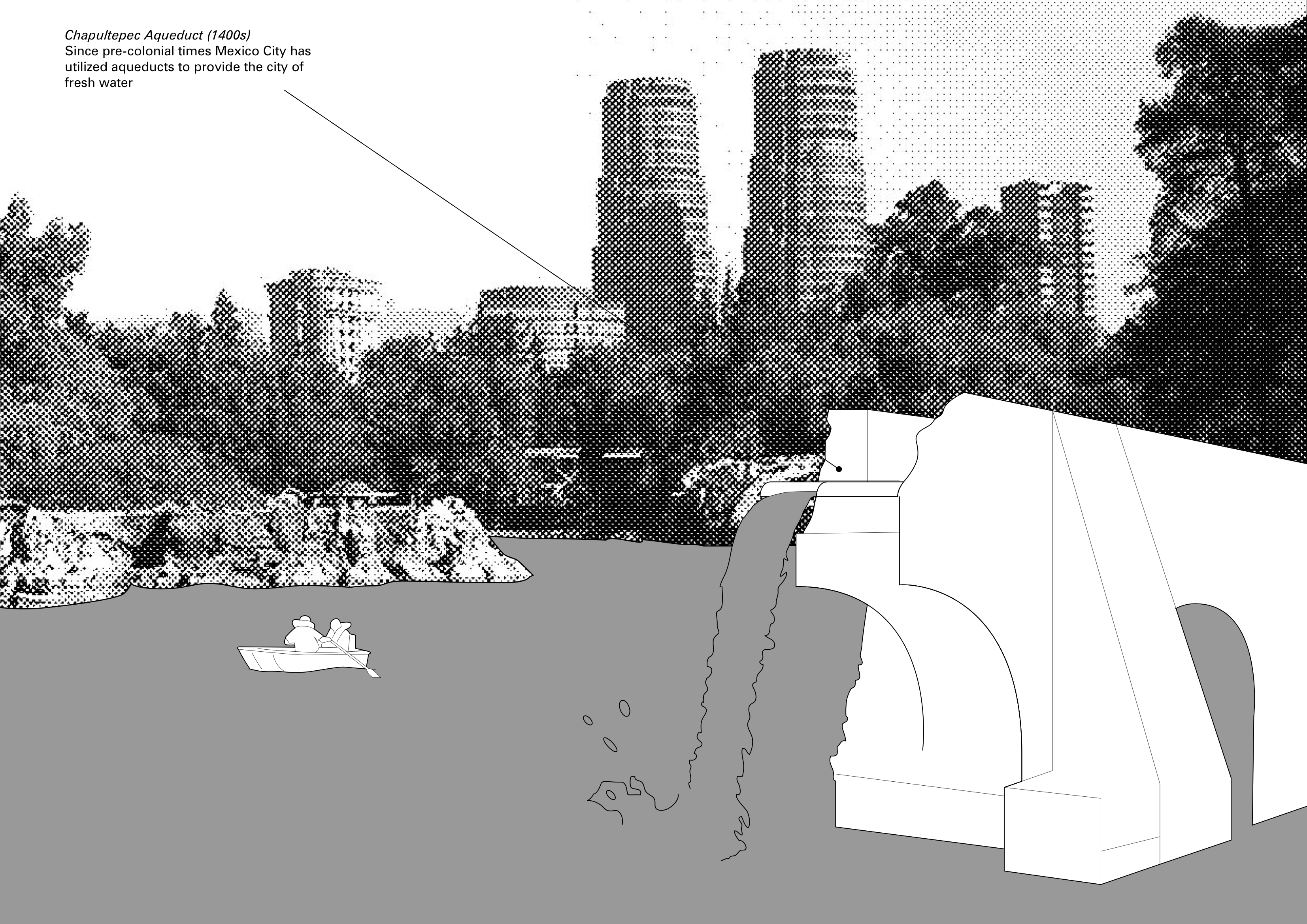
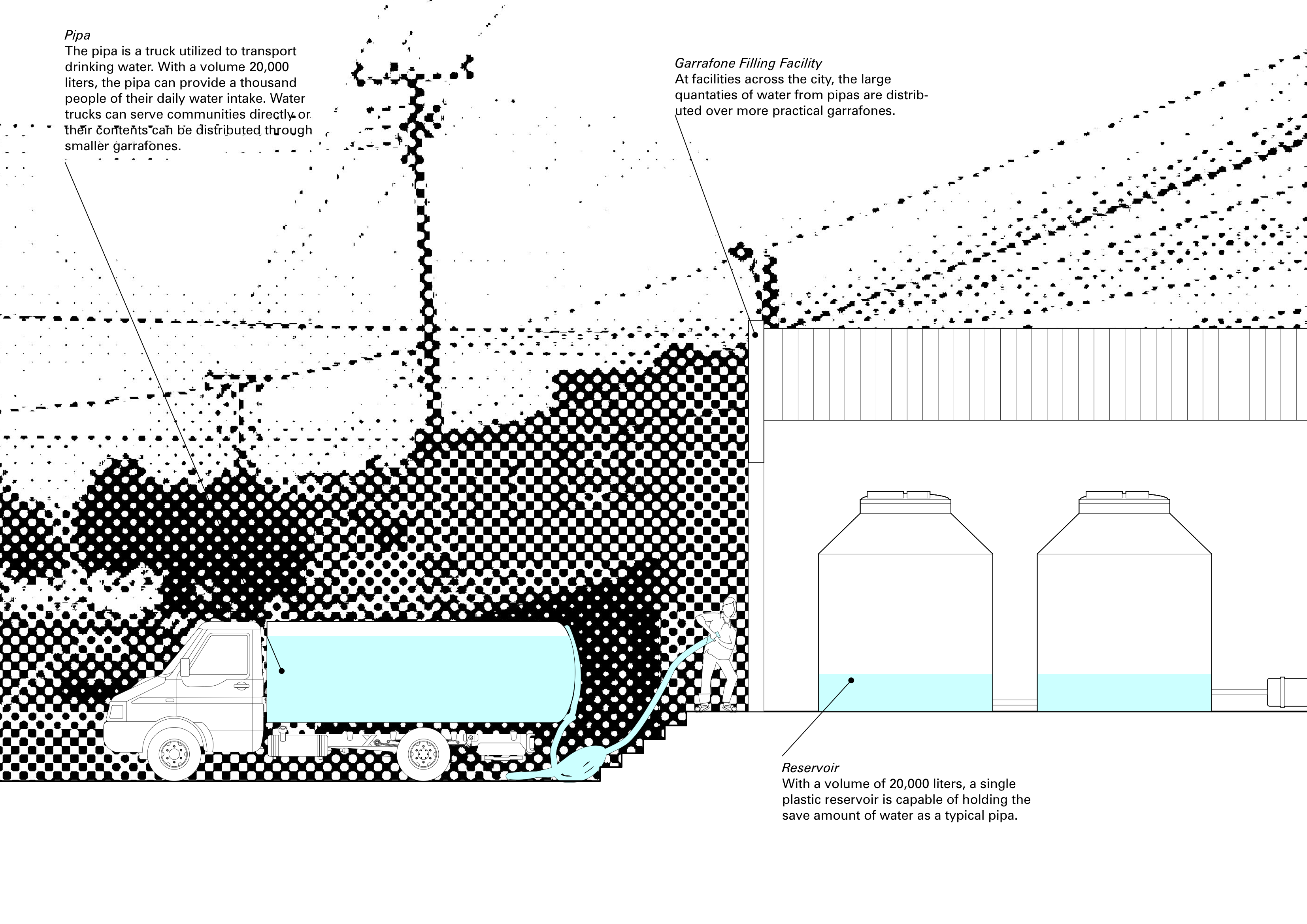
Supply
![]()
![]()
![]()
![]()
![]()
![]()
![]()
![]()
![]()
![]()
![]()
![]()
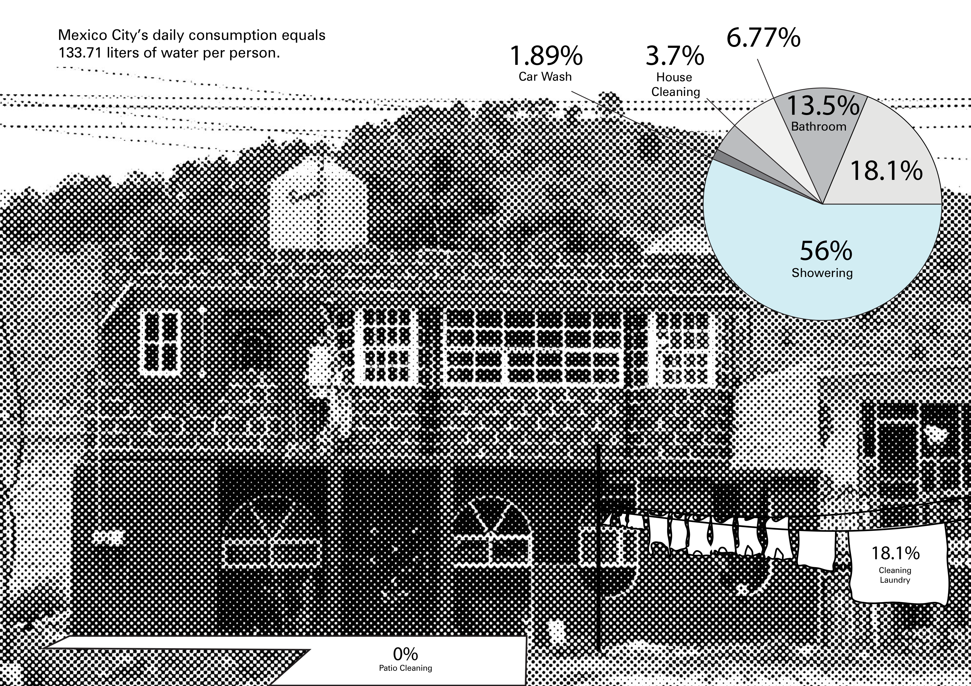
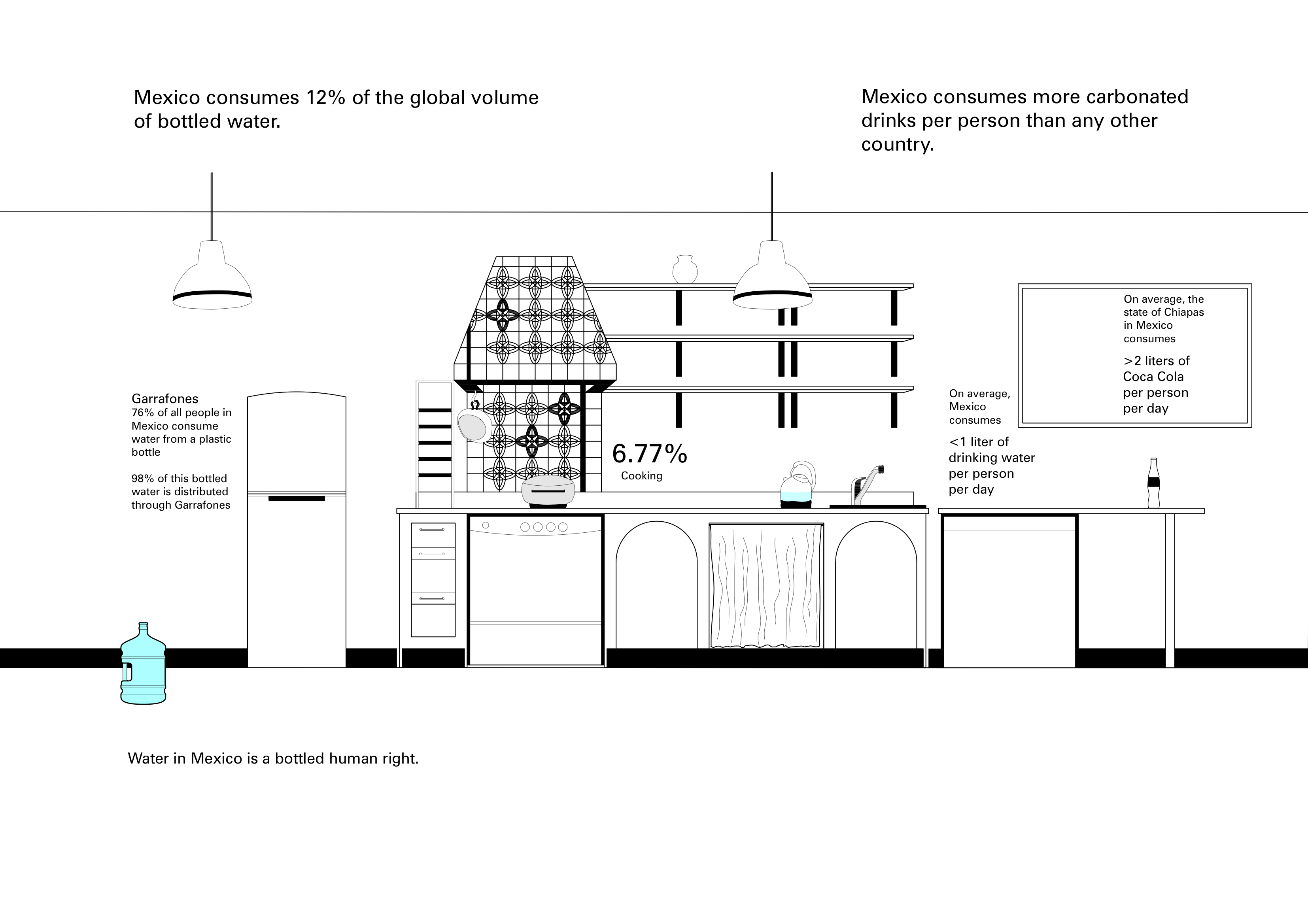
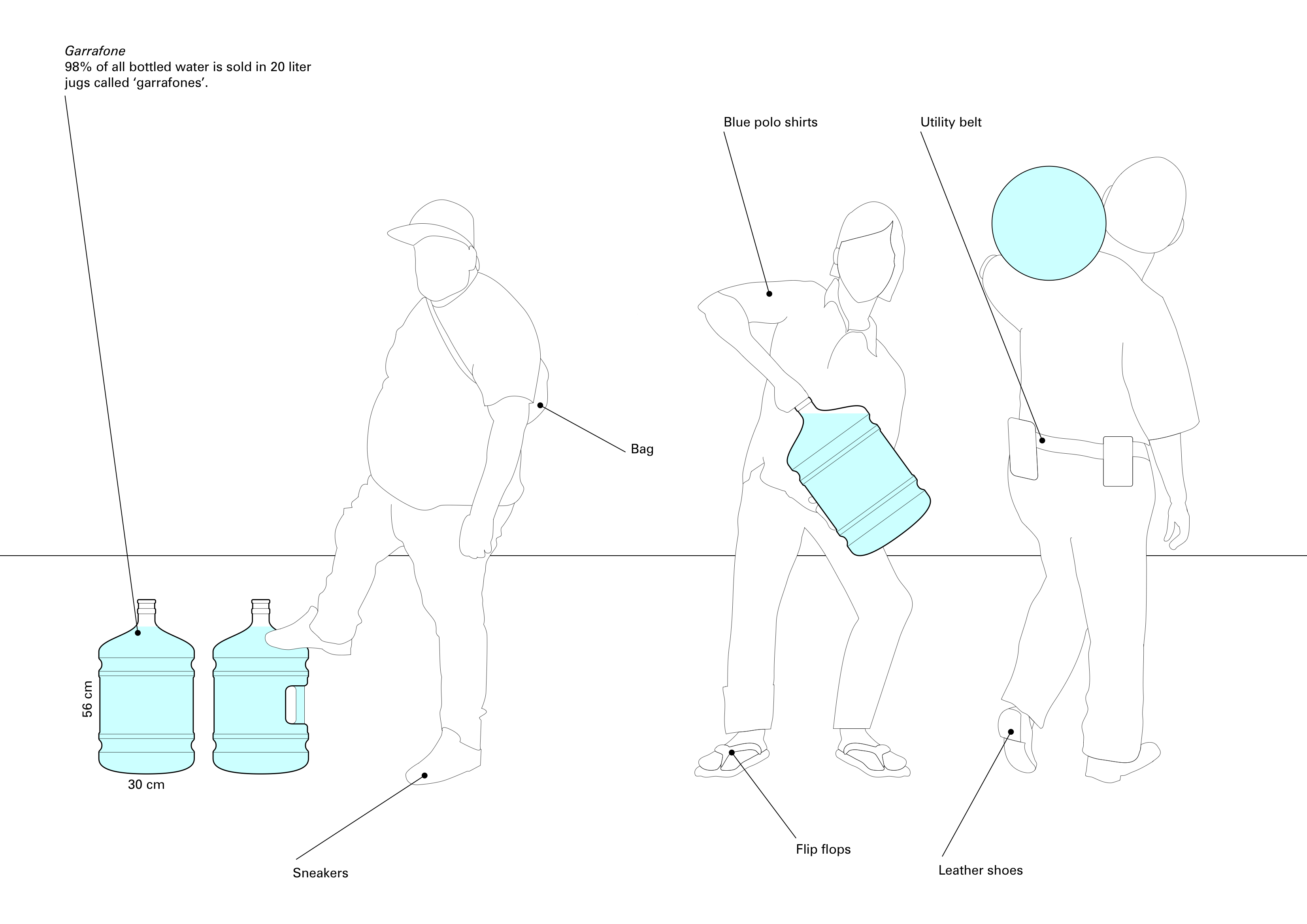
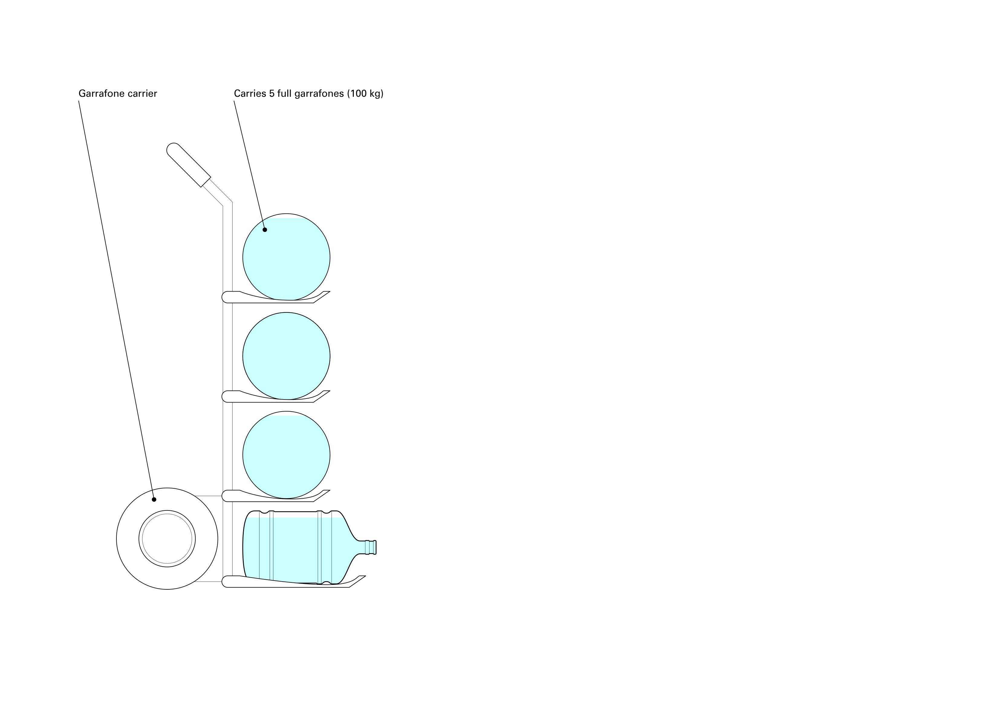
Consumption
![]()
![]()
![]()
![]()
![]()
![]()
![]()
![]()
![]()
![]()
![]()
![]()
![]()
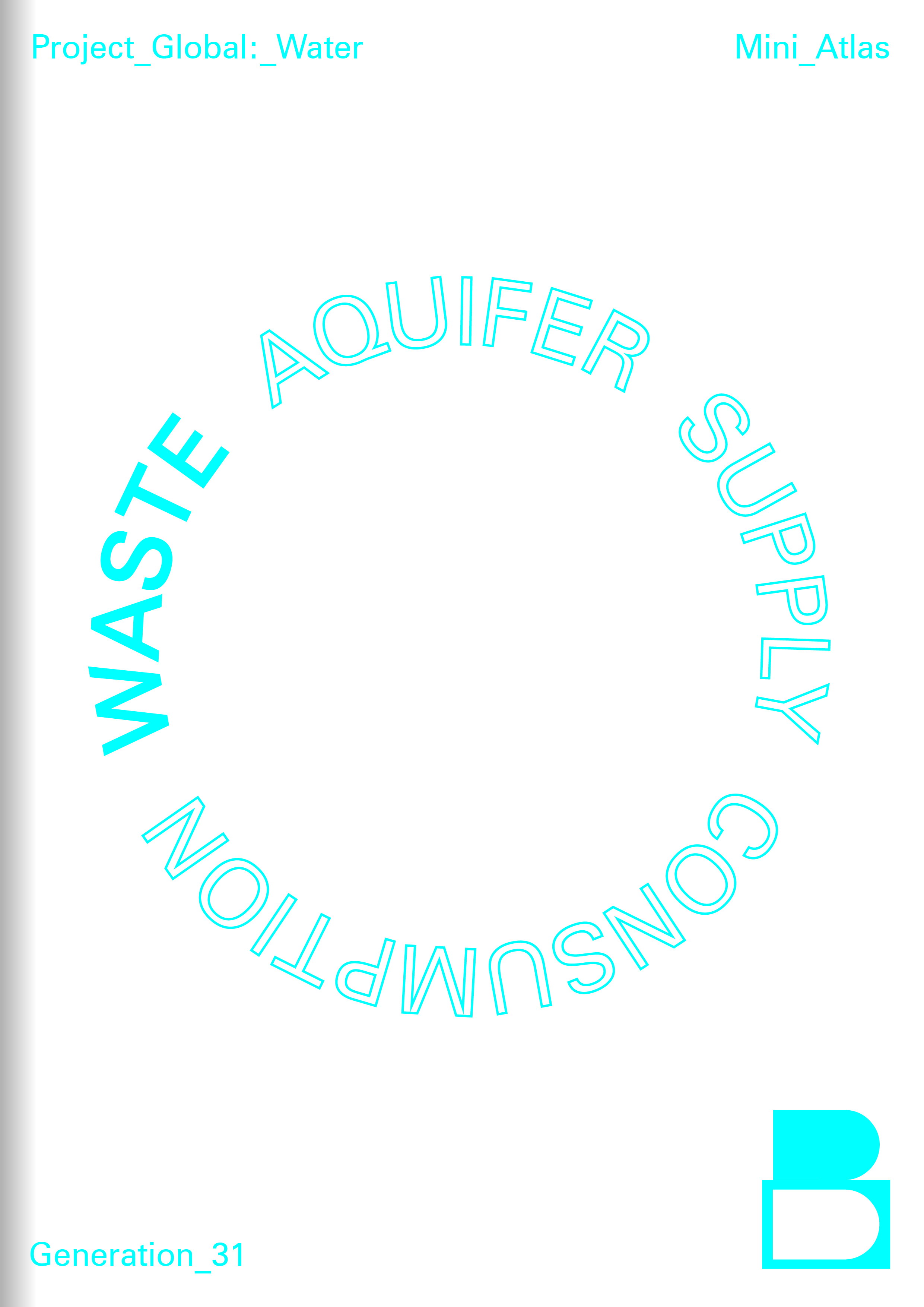
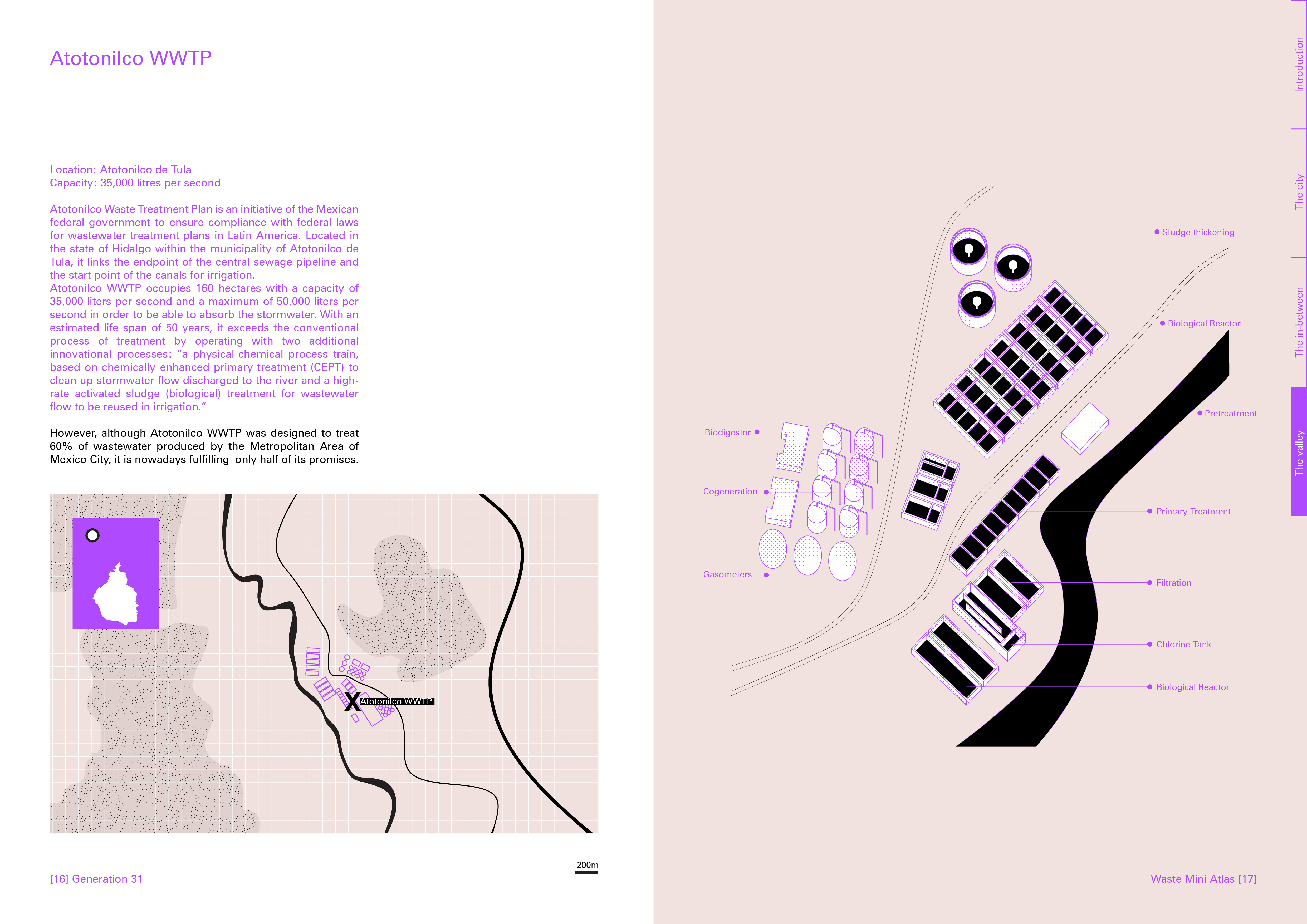
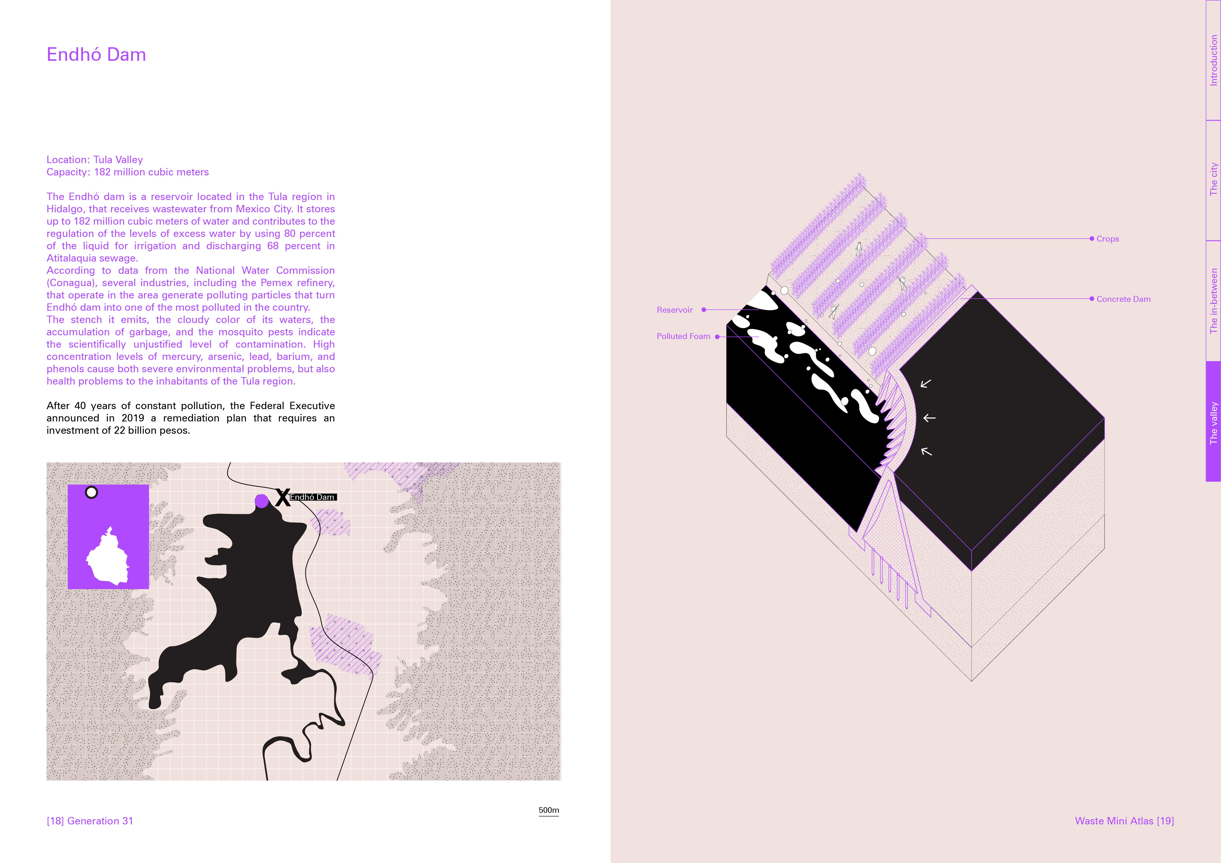
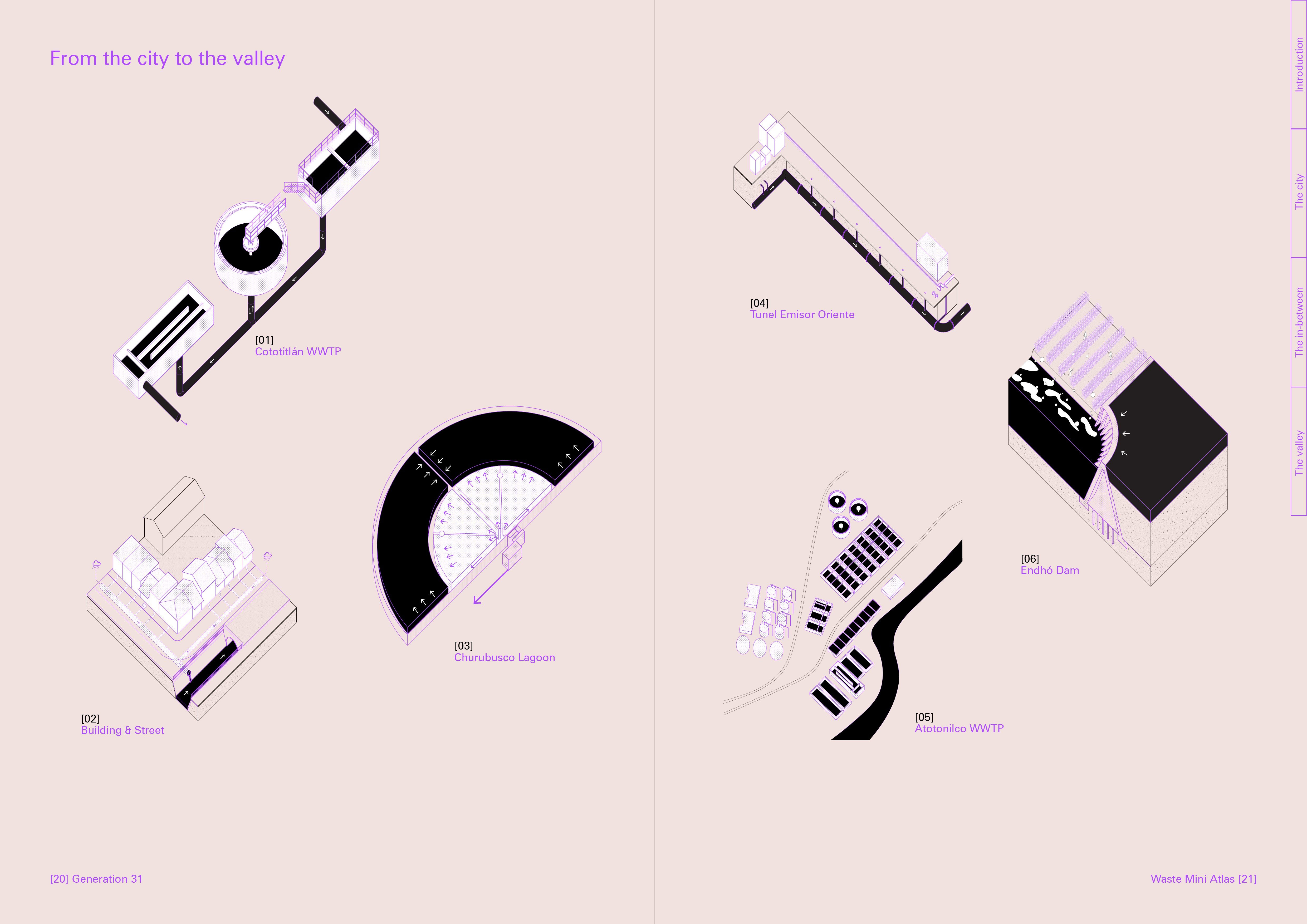
Waste
![]()
![]()
![]()
![]()
![]()
![]()
![]()
![]()
![]()
![]()
![]()
Supply

Consumption
Waste