“I’m planning something geographical.”
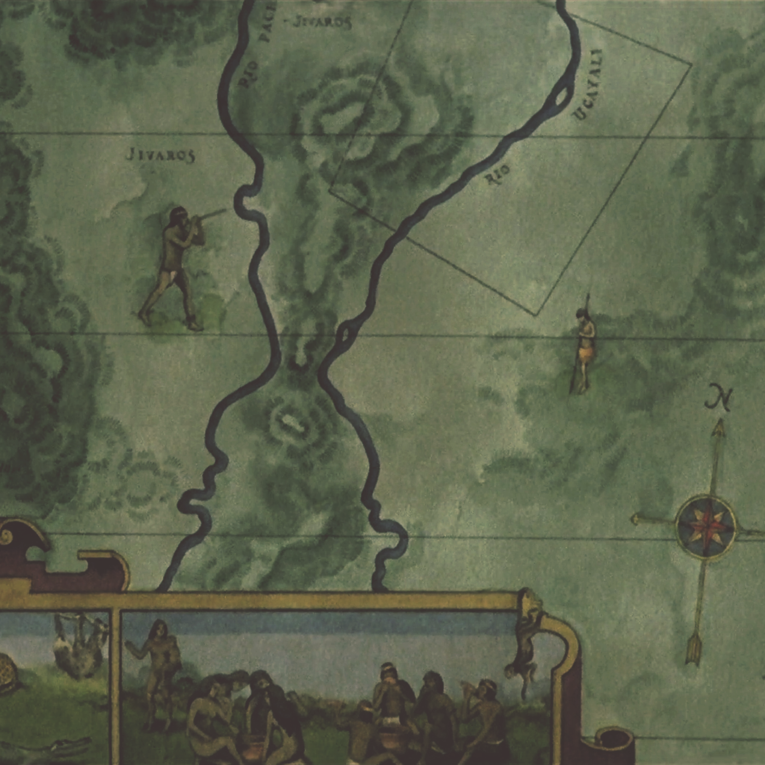
When the baron introduced his rubber kingdom to Fitzcarraldo, he pointed at a trapezial area on the map hanging on the wall. The map - no bigger than a portrait - marked the territory between two tributaries of the Amazon with thin black lines as guidance and coordinates, seemingly insignificant and harmless. Nevertheless, it was one of the most powerful tools for humans to conquer the unknown and turn natural resources into capitals, which without a doubt, still is nowadays. Humans, through the process of surveying, position oneself in relation with the terrain. From rope stretchers to optical theodolites, Yu Ji Tu1 in ancient China to the section method in the US, the apparatus and methods of surveying evolved, while the purpose remains the same - requirement for the management, acquisition, and disposal of land.2
Waters in human society thus have been transformed into information. Such a process first breaks down water bodies into fragments of figures, samples, and sections for objects from different locations can be measured and recorded. Surveyors then construct these pieces of information together to comprehend the water as an autonomous system or part of a system. Finally, to gain control of it, information needs to be abstracted and reduced again, as Latour mentioned in Paris Ville Invisible, through an oblig-opticon lens.3
The story of Fitzcarraldo is the ravings of a madman’s dream, where nature is filled with fornication and asphyxiation, harmonizing in overwhelming and collective murder4 that through transformed information can one retain ration.
← Back to Lexicon
---Brian Sweeney "Fitzcarraldo" Fitzgerald
When the baron introduced his rubber kingdom to Fitzcarraldo, he pointed at a trapezial area on the map hanging on the wall. The map - no bigger than a portrait - marked the territory between two tributaries of the Amazon with thin black lines as guidance and coordinates, seemingly insignificant and harmless. Nevertheless, it was one of the most powerful tools for humans to conquer the unknown and turn natural resources into capitals, which without a doubt, still is nowadays. Humans, through the process of surveying, position oneself in relation with the terrain. From rope stretchers to optical theodolites, Yu Ji Tu1 in ancient China to the section method in the US, the apparatus and methods of surveying evolved, while the purpose remains the same - requirement for the management, acquisition, and disposal of land.2
Waters in human society thus have been transformed into information. Such a process first breaks down water bodies into fragments of figures, samples, and sections for objects from different locations can be measured and recorded. Surveyors then construct these pieces of information together to comprehend the water as an autonomous system or part of a system. Finally, to gain control of it, information needs to be abstracted and reduced again, as Latour mentioned in Paris Ville Invisible, through an oblig-opticon lens.3
The story of Fitzcarraldo is the ravings of a madman’s dream, where nature is filled with fornication and asphyxiation, harmonizing in overwhelming and collective murder4 that through transformed information can one retain ration.
← Back to Lexicon
“That's my area. From the Pongo to the mouth of the Ucayali,” said the rubber baron to Fitzcarraldo.
Sources: Werner Herzog, Fitzcarraldo, 1982.
Sources: Werner Herzog, Fitzcarraldo, 1982.
- https://upload.wikimedia.org/wikipedia/commons/5/52/Yuji_tu_-_enhanced_contrast.png
-
Land Survey Handbook, Division of Realty National Wildlife Refuge System, 2015.
-
Bruno Latour & Emilie Hermant, Paris: Invisible City. Trans. Liz Carey-Libbrecht (Paris: La Découverte-Les Empêcheurs de penser en rond, 1998), 28.
-
Werner Herzog on Nature…, YouTube video uploaded by user KubrickIsAGod.
