The “Street Section” replenishes the possibilities of a two-dimensional drawing. From the past till now, it has been the main tool for urban planning and in particular for outlining its challenges. The sectoral approach is mainly used to describe the integrated urban subsystems, such as mobility networks, sewage systems, urban fabric, and other infrastructures. The section is seeking sustainable design solutions for the challenging and complex nature of our cities.
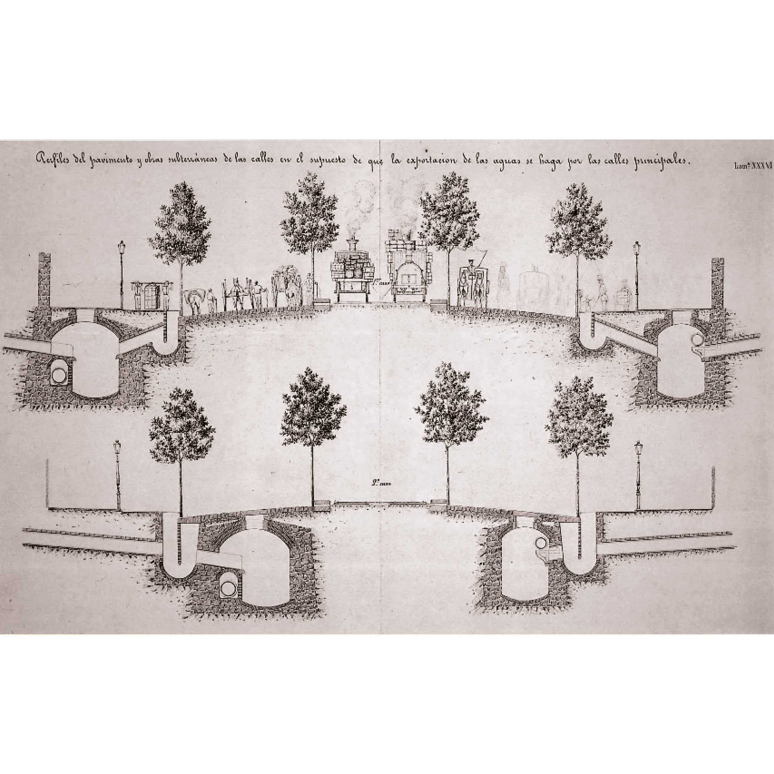
Looking back in the history of urban planning, in particular in today’s immense metropolis, the street section is encountered, contrary to our preconception that infamous plans were built, as the main tool of exploring the function of the city. Idelfons Cerda, the protagonist of Barcelona’s urban development, is a case in point. His main attempt in “the Eixample extension of Barcelona'' was the improvement of the civilization through the city’s adaptation in the new needs of transportation and hygiene.The most representative image of his design might be the Original plan of the extension of Barcelona (1859) that illustrates the infamous grid, however Cerda defined the system of Barcelona’s urban utility network by the “Street Section”. In the Atlas of the Barcelona Ensanche Draft, published in 1855, a series of sections that reveal the underground systems of Barcelona in combination with the city above, were represented with the tool of section.
The “Street Section” implements an expanded level of information that indicates the depth of the drawing, or in other words the associated behaviors and qualities of the street. It unfolds the dialect of different systems, from specific to generic, from the small to the large scale and from engineering to architecture. It describes the variety of networks of the city and the multidisciplinary character of urban planning. It unravels ongoing systems that either interpenetrate or parallelly contribute to each other.
← Back to Lexicon
Pavement sections and subterranean works considering that the water export as done in the principal street, Ildefons Cerda, 1855
Sources: Atlas of the Barcelona Ensache Draft, 1855Karl August Wittfogel, “Oriental Despotism: A Comparative Study of Total Power” Yale University Press, 1951
Sources: Atlas of the Barcelona Ensache Draft, 1855Karl August Wittfogel, “Oriental Despotism: A Comparative Study of Total Power” Yale University Press, 1951
