Seeking to explore power as crucial factor in the design of the built environment, we will look at energy systems and related objects, from sites of generation to spaces of consumption, from distribution networks to control rooms.
Tutors: Filip Geerts and Sanne van den Breemer
Director of Studies: Salomon Frausto
Contributors: Santiago Ardila, Juan Benavides, Daniella Camarena, Stef Dingen, Marco Fusco, Jack Garay Arauzo, Theodora Gelali, Shaiwanti Gupta, Hao Hsu, Marianthi Papangelopoulou, Felipe Quintero, Gent Shehu, Siyuan Wang
@theberlage.nl


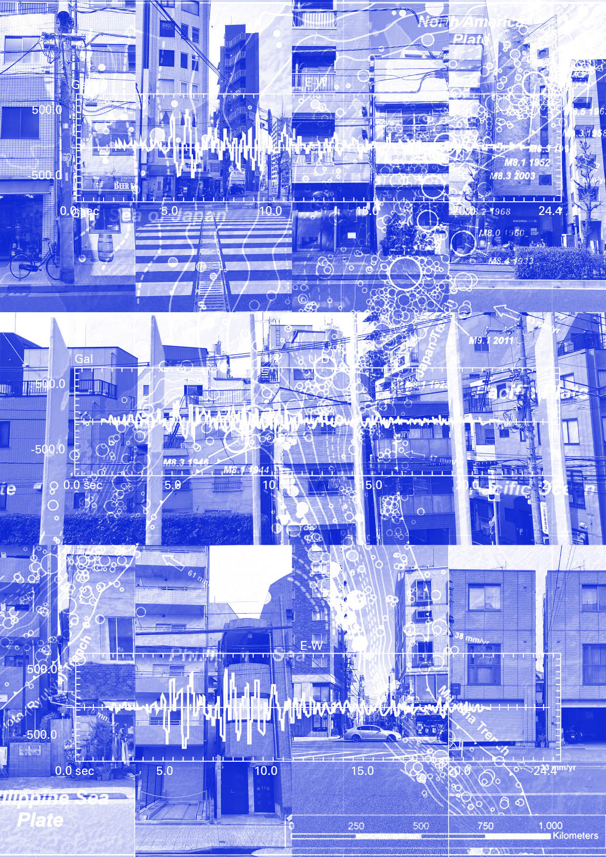
Shindo (震度)
Failure of a system, Biomass, Recycle, Metropolitain, Object, Earthquake, Construction, Governance, Illustration
The Japan Meteorological Agency Seismic Intensity Scale quantifies the intensity of local ground shaking caused by earthquakes in Japan. It is expressed as a numerical value called shindo (“seismic intensity”) and its calculations are obtained from a network of about 200 seismographs and 600 seismic intensity meters. Additionally, 3,600 seismic intensity meters are managed by local governments and the National Research Institute for Earth Science and Disaster Prevention (NIED)1 that together with JMA form a system that besides providing precise measurements, also illustrates each intensity scale with a description on its perceived effect on people at each observation site.
Nonetheless, the failure of such a system rests precisely on its dual relationship between an objective observation and humanistic interpretation, for it took three detrimental earthquakes to move from 1884s four-increment scale, to 1894s 0-7 numerical scheme and lastly, following the Great Hanshin Earthquake of 1995, merging numbers and descriptions to a reconfigured scale of 10 increments ranging from: 0–4, lower/upper 5 (“weak/strong” 5), lower/upper 6 (“weak/strong” 6), and 7 as the highest value.2
In an exponential competition with nature, Shindo translates its viability not only to its own referential system, but also dramatically manifests itself on the territory of Japan.
The updates in scales, the change through time, the exponential relationship between small and big earthquakes, makes Shindo a power tool that proliferates in its systemic translation from earthquake measurements to the distance of gaps in-between the buildings of Japan. A paradox that reverberates a ‘tool of measuring disastrous events’ to the territorial distribution of edifices. The territorial gaps assess a contrapuntal relationship with earthquakes; besides remaining in accordance with the political, urban and technical aspects of buildings, they are also inherently instrumental to the intensity of earthquakes. Subsequently, Shindo becomes a par excellence model of the coalescence between socio-politics and nature itself. For Shindo’s magnificence escapes its own referential system (seismic measurement) only to echo emphatically as an instrument of the territorial distribution of mere gaps.
1. Japan Meteorological Agency Brochure (March 2018), https://www.jma.go.jp/jma/en/Publications/publications.html (Accessed March 5, 2020)
2. Explanatory Table on Japan Meteorological Agency (JMA) Seismic Intensity Scale, https://www.jma.go.jp/jma/en/Activities/inttable.html#taikan (Accessed February 26, 2020.)
See ephemera: 32, 43