Seeking to explore power as crucial factor in the design of the built environment, we will look at energy systems and related objects, from sites of generation to spaces of consumption, from distribution networks to control rooms.
Tutors: Filip Geerts and Sanne van den Breemer
Director of Studies: Salomon Frausto
Contributors: Santiago Ardila, Juan Benavides, Daniella Camarena, Stef Dingen, Marco Fusco, Jack Garay Arauzo, Theodora Gelali, Shaiwanti Gupta, Hao Hsu, Marianthi Papangelopoulou, Felipe Quintero, Gent Shehu, Siyuan Wang
@theberlage.nl


Part 2: Atlas
The second part relates the principles as documented in Part 1 to the geographic specificity of Tokyo, and the related territory. From the Taiheiyo Belt—the country’s urbanized spine that runs along its plains—to the 23 wards—the city’s smallest administrative areas—to the city block, the work addresses a sequence of scales, and explores how each relates to the systems and objects of study.
13 Maps of Japan
6 Mini Atlases about Power and Energy
1 Model for Architectural Projects
Scroll down to begin
︎
Thirteen maps of Japan:
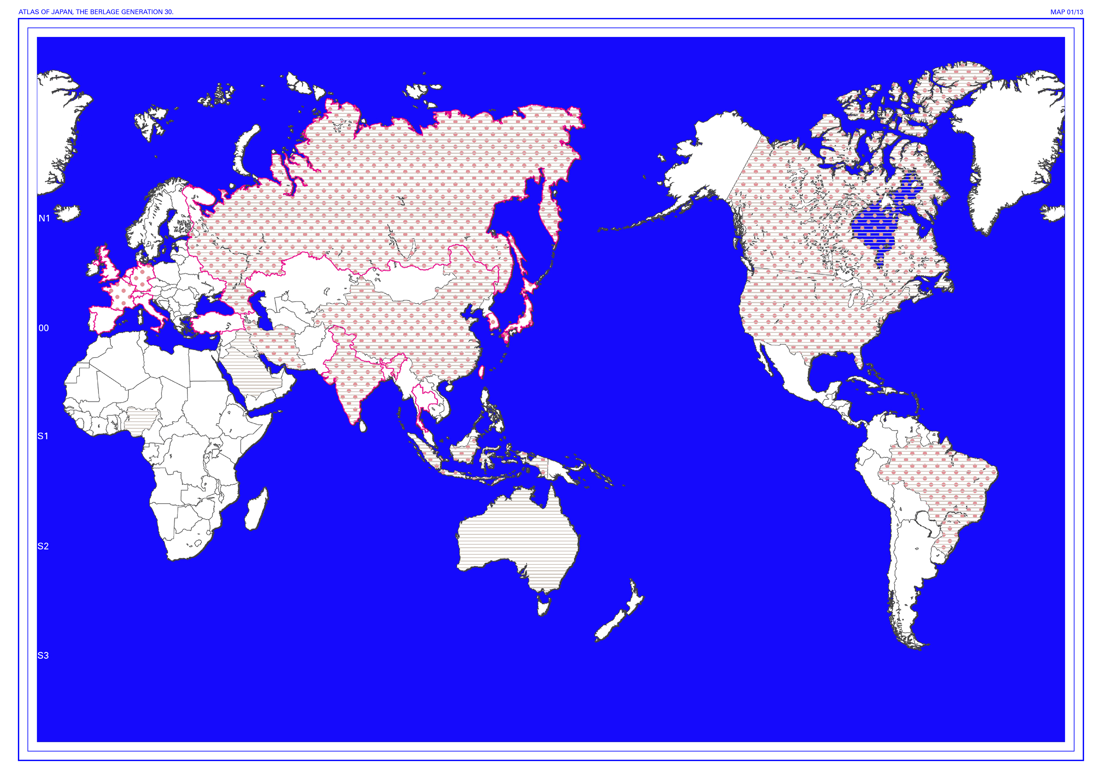
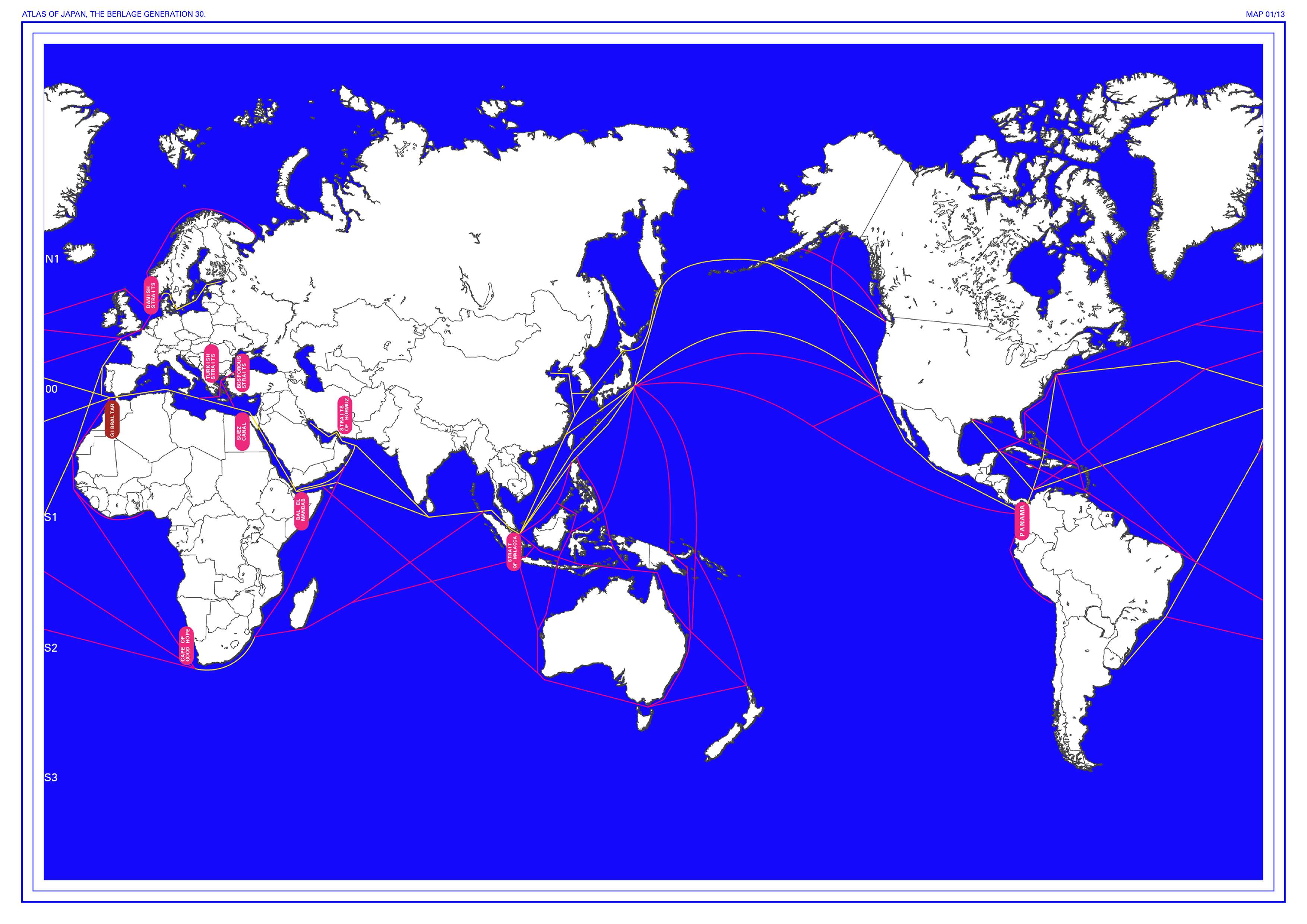
1. The World.Regulation and Diversification of Energy Resources Map
1. The World.Regulation and Diversification of Energy Resources Map
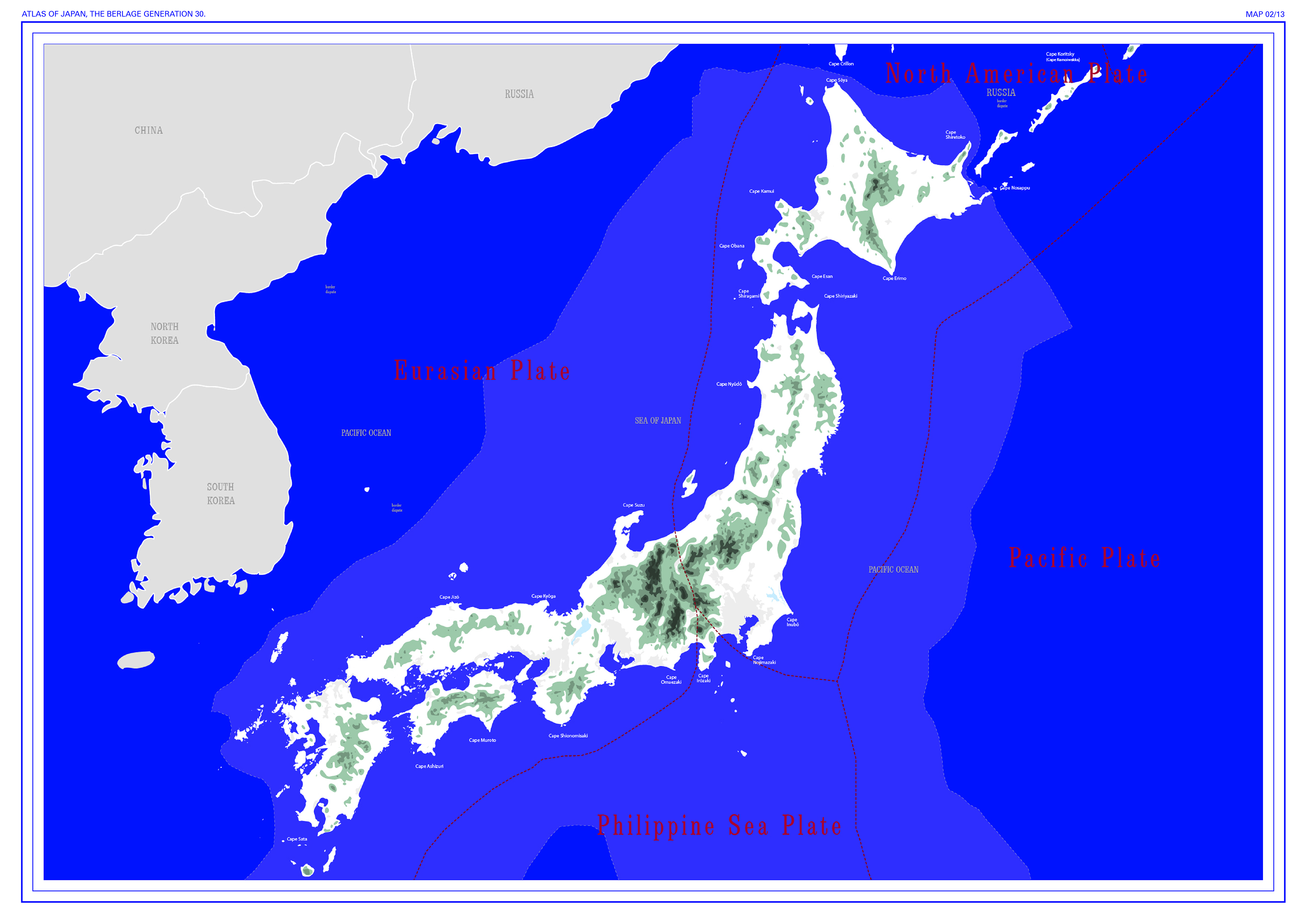
2. Japan. Power Plants & Other Maps
3. The Taiheiyo Belt. The Megalopolis Map
4. Gokaido. Energy Transmission Map
5. Shuto-Ken. Energy Transmission System Map
6. Tokyo Bay. Energy Sources Map
7. Tokyo To. Energy Distribution & Substations Map
8. Special Wards. Clean Authority Map
9. Tama Area. Production & Consumption Map
10. Shinjuku. Energy Distribution & Consumption Map
11. Toyosu - Todoroku - Mizuko. Urban and Suburban Condition Map
12. Chome - Kami-Ikebukuro 2-Chome. Neighbourhood Relations Map
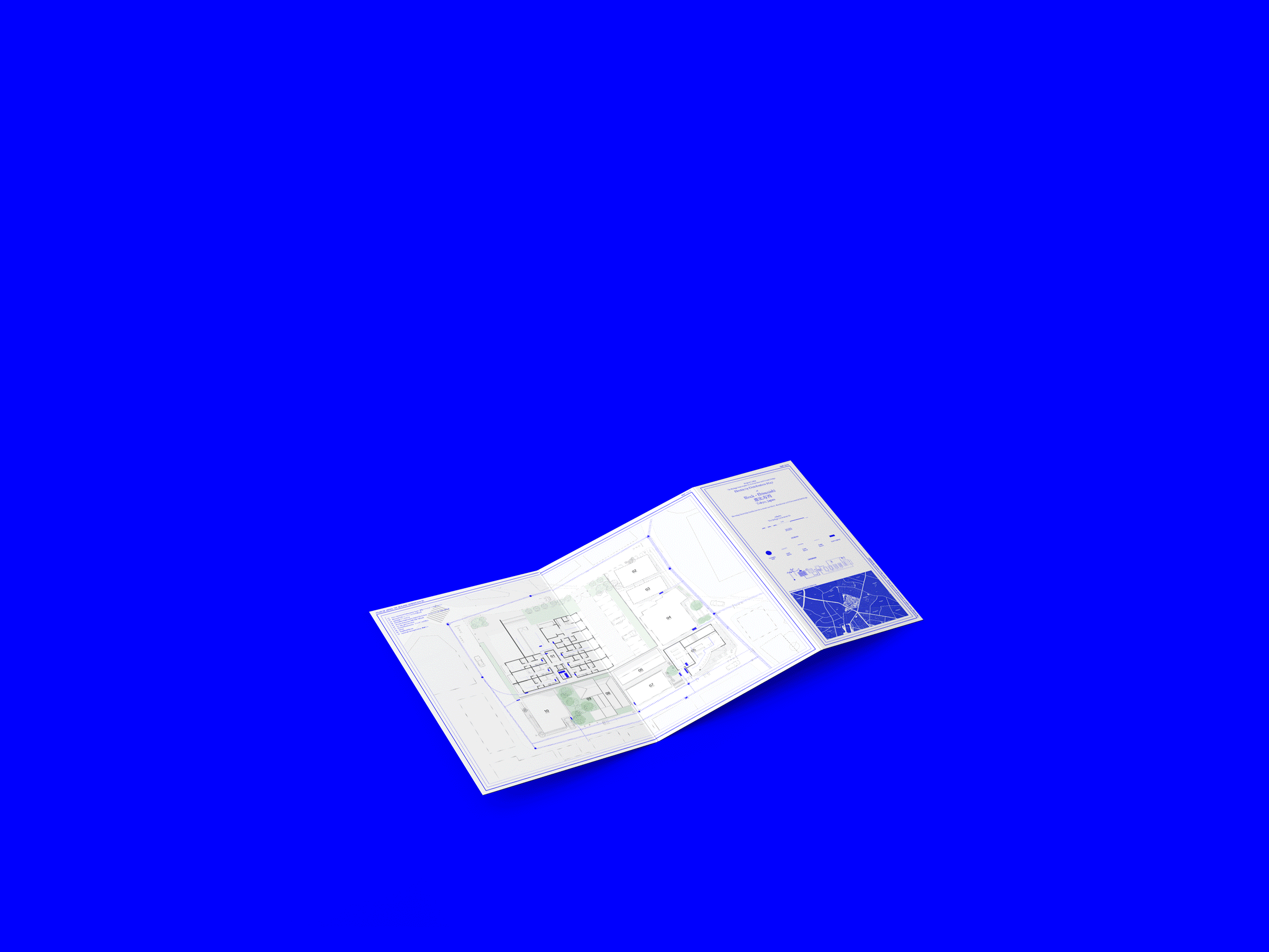
13. Block - Ebisunishi. Electricity Distribution Map

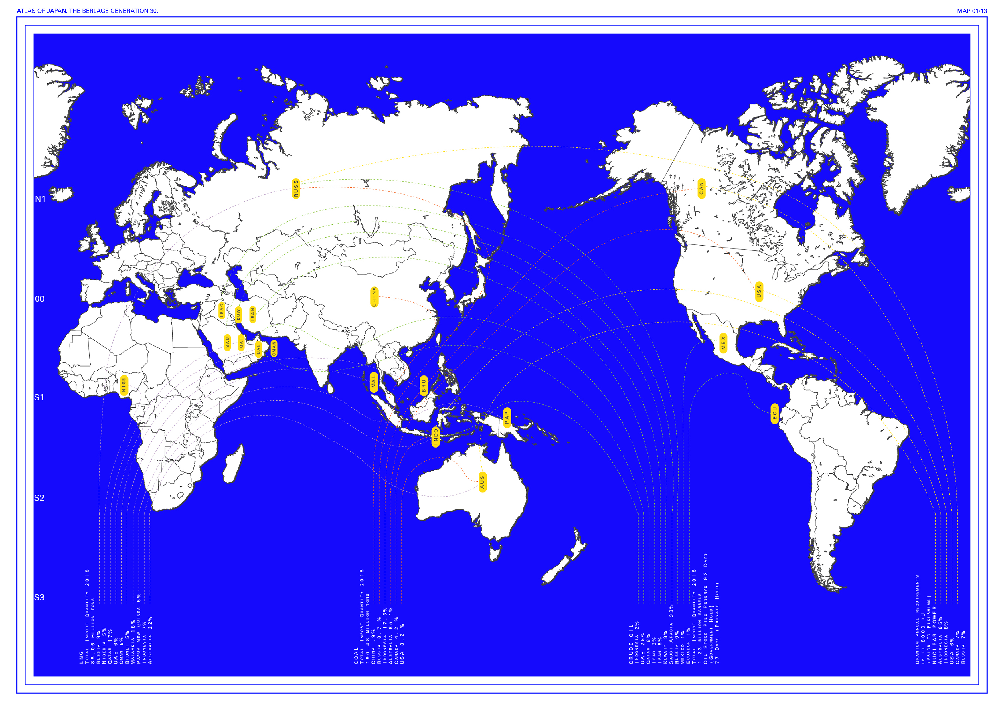
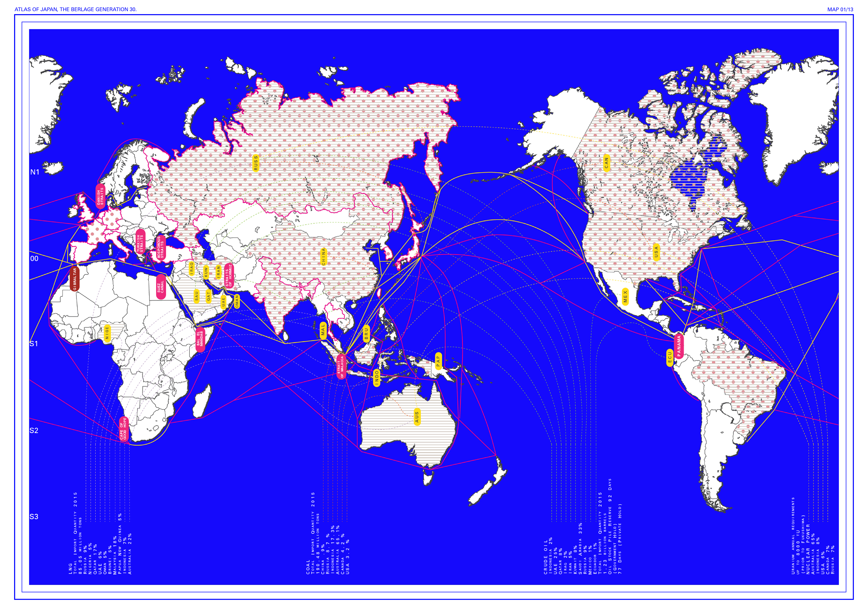
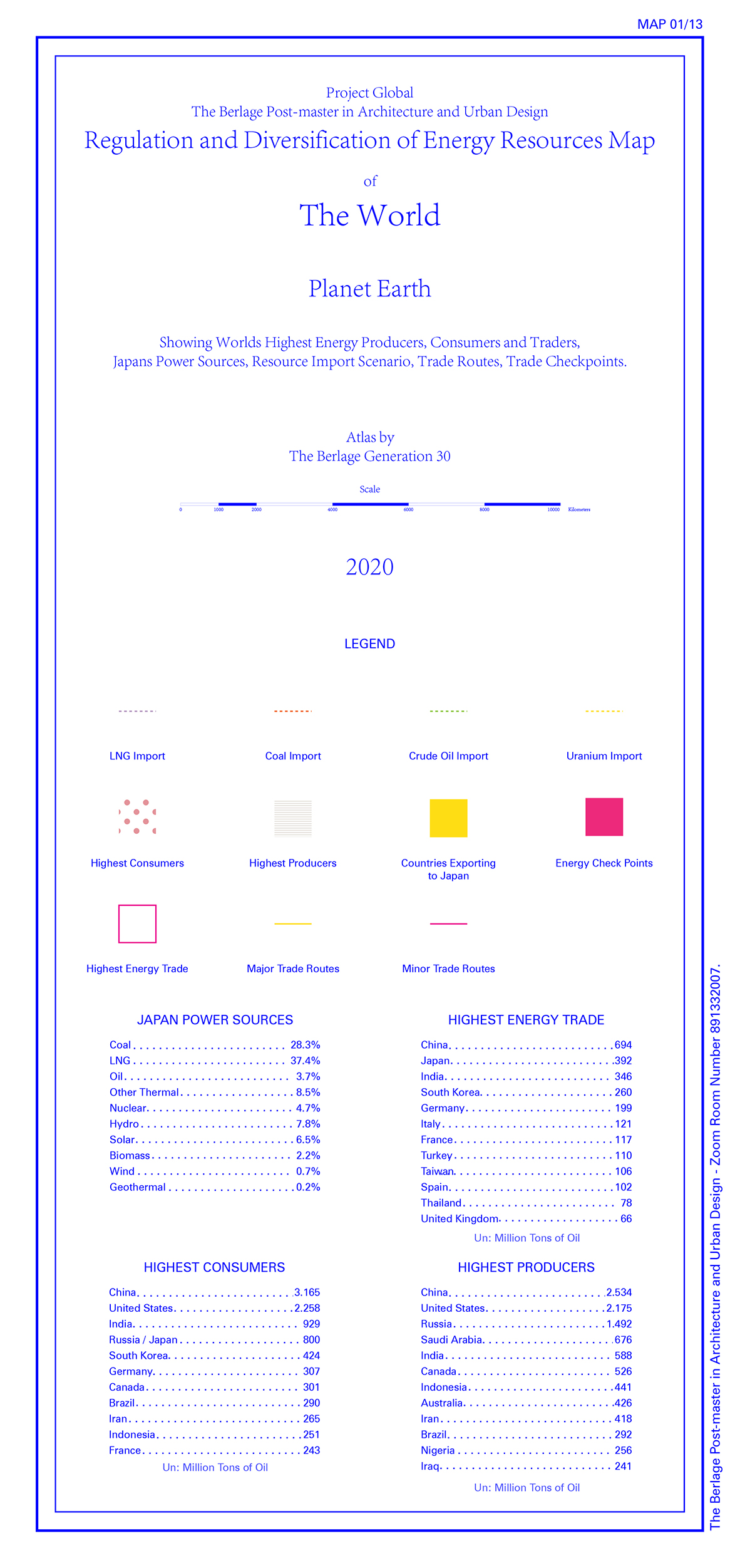
1. The World. Regulation and Diversification of Energy Resources Map